Couplet culvert completed

After delays to coordinate with patches on the upper couplet and the discovery of a surprisingly large rock, construction of the new culvert on the lower couplet is complete. Notice how deep the concrete culvert frame is and then how little is exposed above the water in the last picture. The bottom is filled with natural stream bed material so fish can pass through easily.

20130812CulvertCompleted01

Crews discovered a very large boulder that needed to be removed to install the culvert.

20130828CulvertCompleted02

Work crews guide the box culvert sections into place


20130828CulvertCompleted03

The work crew guides a cap onto the culvert sections

20140131CulvertCompleted04

The repaired culvert draining on a rainy winter day


Related Posts

Mailbox parking problems

20131105ParkingProblems1

20110415ParkingProblems2

Signboard appears offering land for sale in April, 2011
  

Trailhead parking for Mailbox Peak has been a problem ever since the hike started appearing in guidebooks in ~2007 and it’s popularity started rising. The DNR built a new parking lot off the road in 2013, but it’s not scheduled to open regularly until the new Mailbox Peak trail is completed in 2014. For many years hikers parked in the pullout on the north side of the road, and in the small loop in front of the gate leading to the trail itself. But some trouble started in 2011 when for sale signs appeared for property on either side of the road.
20110501ParkingProblems5

Typical busy day at Mailbox with the north pullout full and overflow parking along the road


20110415ParkingProblems3

Location of parcels

20121102ParkingProblems4

“Sale Pending” in 2012

Nothing changed for a year and a half until the property was nearly sold and “Sale Pending” placards appeared. But something clearly went south because the property was not sold and a year later four large concrete blocks were placed in the pullout parking area with messages making it very clear that parking was forbidden. In the next couple weeks an access road to the parcels on the south side was cleared and more concrete blocks showed up.
20130903ParkingProblems6

Excavator opening access to property

20130903ParkingProblems7

Cleared road provides access to property for sale


This site does not cover private property issues other than transfers to public status, so no attempt will be made to explain this sequence of events. However, as of February, 2014 the DNR seems to be negotiating to purchase these properties to prevent development from creeping farther up the valley.

Trail 1003 relocation

MFK1003RelocationMap
The Forest Service has proposed a minor reroute of the Middle Fork trail #1003 between the Taylor River and Dingford Creek. The reroute will avoid an area prone to washouts and landslides caused by normal channel migration of the Middle Fork river.

Washouts

Washouts

Sink hole

Sink hole

Flagged reroute partially follows the old railroad grade

Flagged trail partially follows the old railroad grade

Flagging along proposed reroute

Flagging along proposed reroute


Download 94062_FSPLT3_1450091.pdf
Forest Service proposal PDF

Mount Si 444 fire

At about noon on July 26, 2013 a fire broke out on the lower elevations of Mount Si along 444th Ave SE. It was probably human-caused, and was named after after the road. Fire fighters had the advantage of using both the Boulder Garden loop and 444th Ave SE to get equipment in the fire area to control the blaze. The fire enveloped three prominent balds visible from the valley – Foundation Rock, BCD Vista and Moss Vista. The first two are rarely visited, but Moss Vista is the largest of the three and has a high overhanging wall with difficult rock climbing routes. The top of Moss Vista is also a popular Boulder Garden Loop side trip for picnics and views, at least for those who know it is there. It is marked on the Green Trails map but there are no signs along the maintained trails showing how to get to it. For the most part the fire burnt the understory and spared the crowns of most trees, so recovery should be relatively rapid.

20130726SiBurn01

Google Earth view showing extent of the burn area


Related coverage

  • 2013/07/26 Wildfire breaks out on Mount Si
  • 2013/07/26 Crews continue to fight wildfire on Mount Si
  • 2013/07/26 Firefighters battling wildfire on Mt. Si near North Bend
  • 2013/07/26 Wildfire burning at Mount Si as King County issues burn ban
  • 2013/07/29 Mount Si wildfire is three-fourths contained, human-caused
  • 2013/07/29 Recreation Update: Mount Si & Little Si open
  • 2013/07/26 DNR, EFR, prison crews attack Mount Si’s ‘444 Fire’
  • 2013/07/31 Wild fire to smolder for several days
  • 2013/08/06 Garden Loop Trail closed indefinitely, fire fully contained, being patrolled
  • 2013/11/06 Forest rebounds after fire

Two teens rescued in Pratt

20130702RicardoAndBrian

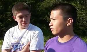
Ricardo Perez and Brian Chim. Photo: King5 News

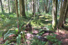
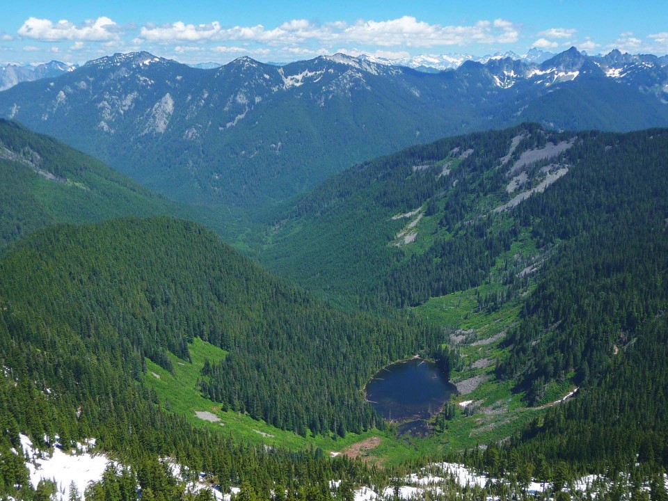
On June 30, 2013 two teens, Brian Chim (19) and Ricardo Perez (18), started up the trail to Mason Lake on what was expected to be a hike and a swim on a hot day. Once arriving at the lake they decided to go further, and continued east-bound on the Mt Defiance trail (#1009) toward Rainbow Lake. At the time, much of that trail was covered in snow. In an interview later they said “at some point we just lost the trail in the snow, and then in the creek bed, and then we thought it was a trail but then we continued down the creek bed and we just lost it”. Heading west to get back to Mason Lake, they ended up too far north and were drawn down into the upper reaches of the Pratt Valley near Lake Kulla Kulla, probably on or near the little-used trail below Sir Richard’s Pond (unofficial name).

By 6pm they knew that they were lost when they came across a waterfall instead of the expected lake. The waterfall was probably the outlet of Lake Kulla Kulla. Brian, the more experienced of the two, felt confident that with warm summer weather they could build a fire and it would not be to bad to spend a night out. Ricardo was not so sanguine, saying “Brian kept me together. I was crying like a little girl. … Brian was there and talked me down.” They spent the first night in a “huge ravine” and the next morning had to descend a “phat cliff … we had to go from tree to tree and a couple times we had to traverse over rock faces with 40 foot drops.” During this period on July 1 they saw a helicopter looking for them, so they waited about 6 hours and when the helicopter did not return they headed down to the Pratt River and “took the river as far as we could go.” As the second night came they accepted that it might take longer to be found than expected, and it was difficult staying warm without long pants or a sweater.

On the third day, July 2, they were spotted by a helicopter search team near the confluence of the Pratt and Spider Lake creek. Upon seeing the helicopter again, one of them shook a small tree to get the rescuer’s attention and they were hoisted into the helicopter and taken to Bandera airfield near I-90 exit 45. For spending two nights out they were doing relatively well, being just a little scratched up. Asked what they would do differently next time Ricardo immediately said “NOT HIKE!” To that non-list, Brian added a first aid kit, an emergency blanket, plenty of food, and “make sure the trail I’m going on is an actual trail”.

20130702PossiblePath

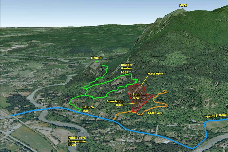
Possible path based on published reports

20130629PrattValley01

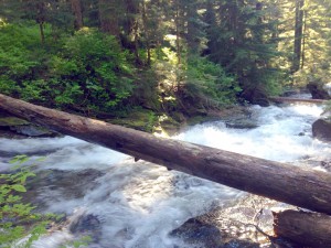
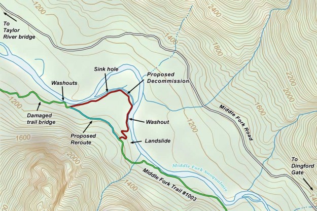
Pratt River conditions at end of July, 2013

20130629PrattValley02

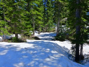
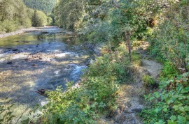
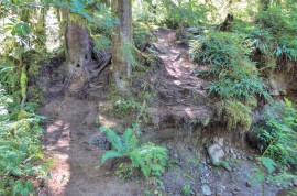
Snow covered trail beyond Mason Lake where they lost their way

Mailbox parking lot opens

As of July 1, 2013 Mailbox Peak hikers can start using the new parking lot on weekends and holidays from 7am to dusk. Don’t know when dusk is? It will be posted on the gate so you will know ahead of time what time to be back to your car. The hours are limited to prevent late-night partying — city (North Bend), county (King) and state (DNR) budget crunches prevent frequent patrols of the parking lot.

As at many easily accessible trailheads, vandalism continues to be a problem. Cars parked along the road experience regular breakins, most often the less busy days (Monday through Thursday) when the perpetrators are likely to be alone long enough to avoid detection. Never leave valuables in the car while hiking.

This gallery captures a series of steps in the construction of the new parking lot. Enjoy the restrooms!

More construction photos in this August 2012 post.

Lower Couplet closure in July

Update July 24, 2013 – this work has been delayed

The lower portion of the couplet road (SE Middle Fork Road) will be closed from July 8 to August 2, 2013. King County is removing a deteriorating culvert and replacing it with a new fish passable one, including streambed gravel. This culvert scores high on the drainage priority list. Scouring is present at the culvert headwall, and the bottom is heavily corroded. The upper portion of the couplet, SE Lake Dorothy Road, will remain open for through traffic as a detour route.

Detour route

Detour route


Notice at couplet intersection

Notice at couplet intersection

Notice at work site

Notice at work site

Weed Watcher Training

A room full of new and experienced weed watchers gathered at the North Bend ranger station on Sunday, June 23 for the annual King County noxious weed training program. The goal of this program is to train hikers to spot and report infestations of invasive species on public lands. Catching these areas early is key to preventing their spread, but there are far too many trails for the staff to monitor themselves. This year the Mountaineers joined forces, focusing on invasive species in Washington’s wilderness areas. For new comers, this training can be an overwhelming introduction because one weed looks pretty much the same as the next. However, by the end of the day everyone could probably distinguish a knotweed from a hawkweed. More information is available at the King County and Mountaineers weed watching sites.

Sasha Shaw, King County Noxious Weeds

Sasha Shaw, King County Noxious Weeds

Sasha Shaw, King County Noxious Weeds

The dreaded butteryfly bush


Sarah Callaghan, Mt Baker-Snoqualmie National Forest

Sarah Callaghan points out an unusually large butterfly bush

Sasha Shaw, King County Noxious Weeds

What’s this weed?

Senate passes Alpine Lakes expansion

On June 19, 2013 the US Senate approved the Alpine Lakes Wilderness Additions and Pratt and Middle Fork Snoqualmie Rivers Protection Act, bringing it a step closer to becoming the law, but still requiring passage in the House. Before celebrating, it’s sobering to remember that we’ve been here before — in 2010 the 111th Congress passed the bill in the House, but not Senate. Then last year the bill did not come up for a vote in either branch of the 112th Congress. Originally introduced in 2007, there’s a chance that 2013 will finally see passage, bringing wilderness status to the lowland forests of the Pratt valley and increased protection for most of the Middle Fork river.

Alpine Lakes Wilderness additions passed by Senate

Alpine Lakes Wilderness additions passed by Senate


Pratt Valley

Spider Lake and the Pratt River valley