Tag Archives: king county

Middle Fork road gets plowed

An unexpected benefit of the paved road became apparent after two snow storms in early December left 6″ of snow on the Middle Fork road. Snow like this is not unusual, but typically doesn’t stick around on the valley floor very long and the road slowly becomes more accessible as trucks and other high clearance vehicles create ruts.

So it was surprising to many visitors that King County plowed the road on Monday, December 12 and then again in the morning on Tuesday. The plowing went as far as the Middle Fork trailhead, including the parking areas there and most of the parking pullouts along the road up to that point. Beyond the trailhead, driving was significantly more difficult because of deep ruts and the monster potholes that begin at the Taylor River bridge. Some vehicles were getting farther up the road, but not all (see photo below). With expected cold weather in mid December the slushy snow will turn to ice. Warmer weather is forecast before Christmas and the road will thaw out but continuing snow accumulation will continue to make it challenging to drive to the Dingford trailhead.
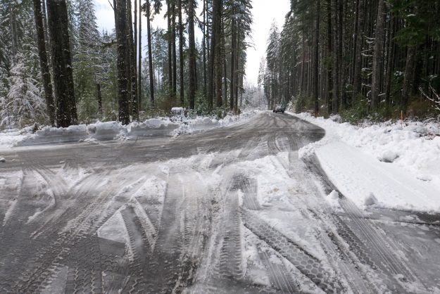
MiddleForkPlowing01

Plowing on both Monday and Tuesday made for an easy drive despite the heavy snow accumulation

MiddleForkPlowing02

The plowing extended all the way to the Middle Fork trailhead, including the various pullouts along the road
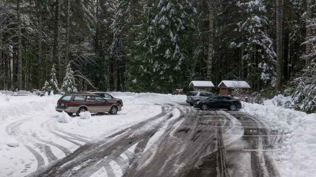
MiddleForkPlowing03

The Middle Fork trailhead would have been inaccessible without plowing. The bathroom is open but not serviced in the winter so bring your own TP.
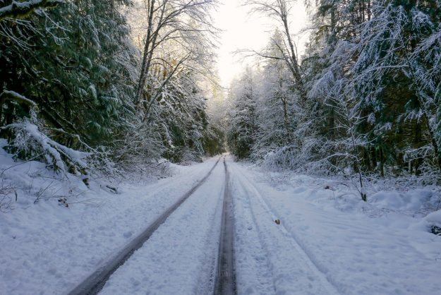
MiddleForkPlowing04

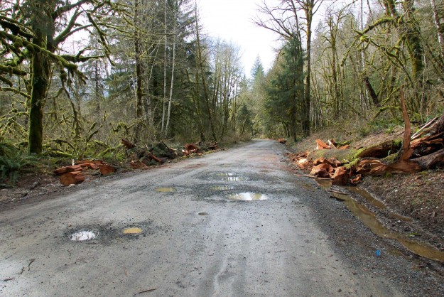
Beyond the Middle Fork trailhead the road was not plowed and only passable to high clearance vehicles with good traction
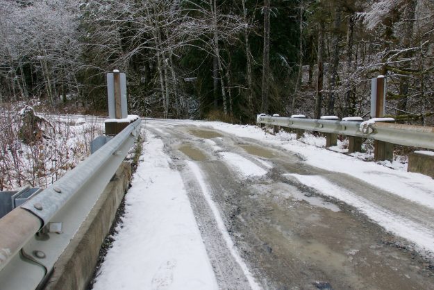
MiddleForkPlowing07

Taylor River bridge potholes before the most recently snow storm. They can be slippery and difficult to drive through when traction is reduced by slush and deeper snow.
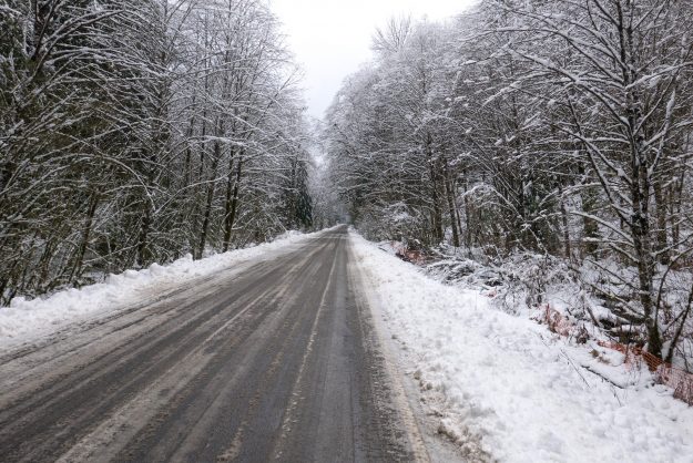
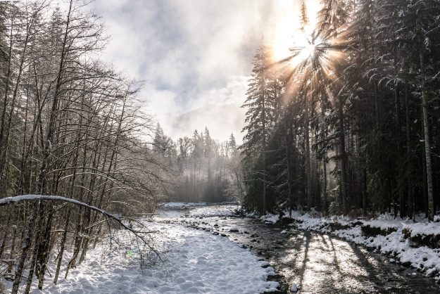
MiddleForkPlowing05

Whether walking or driving, winter in the Middle Fork can be beautiful. Here the sun shines through cold fog at the Taylor River bridge.

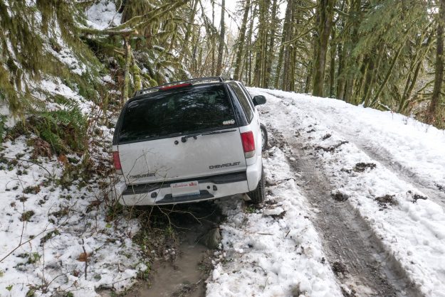
This Chevy Trailblazer tried to drive up Hell Hill and ended up stuck in a muddy ditch. Later his friends came in a pickup to pull the vehicle out.

Sitka spruce tree blocks road

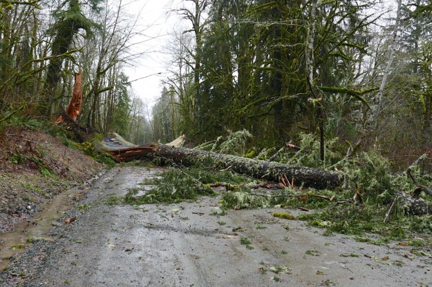
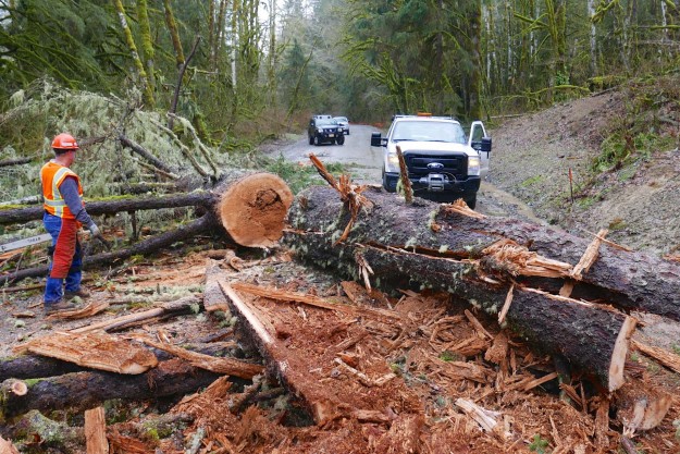
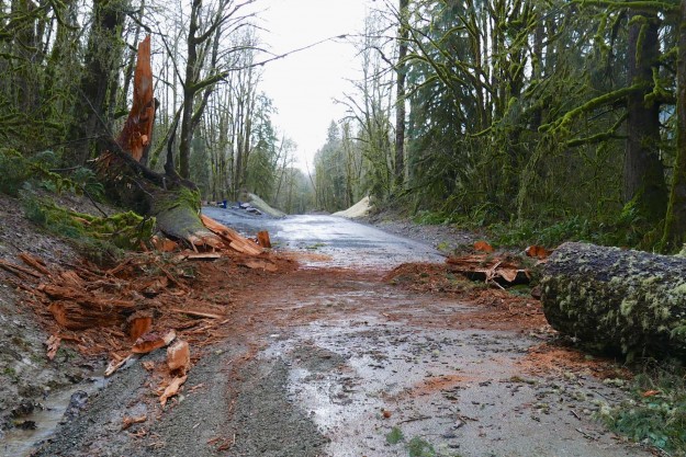
A windstorm on the evening of January 28, 2016 was the final blow for a large rotting Sitka Spruce tree by the Bessemer Road gate, about 7 miles up the Middle Fork road. It fell across the road, completely blocking all access to the upper valley. Two early arrivals parked on the side of the road and did their planned bike ride or hike from there. But a couple heading for Goldmyer Hot Springs were determined to get through so drove back home to get a chain saw and try to get enough of the tree cut out to drive through. Soon after they started working other locals that often help with tree clearing showed up and steady progress was made clearing the 3-foot diameter tree. After about an hour a 2-person King County road crew arrived with bigger chainsaws and a truck with a winch. They were able to cut through a healthier part of the tree and drag a large section out of the way. Normally King County is not responsible for road clearing because the paving project is not done, but they came out because they were concerned that people farther up the valley might be stranded. A path was finally cleared by about 3 PM.

20160129SitkaSpruceDown01

Big Sitka Spruce blowdown by the Bessemer Road junction

20160129SitkaSpruceDown02

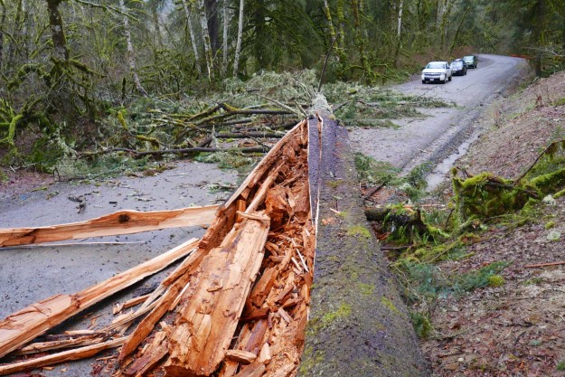
Vehicles headed up the valley are blocked

20160129SitkaSpruceDown03

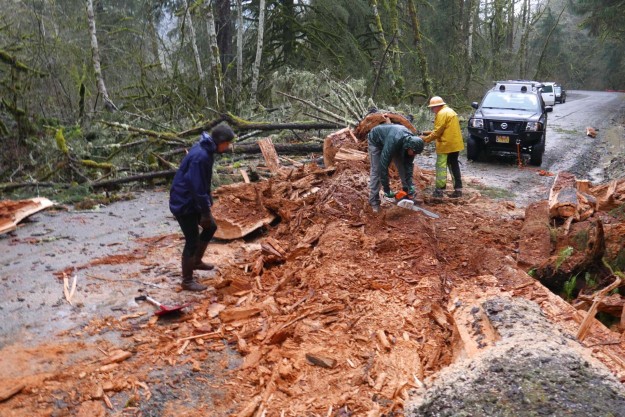
Volunteers start cutting through the rotten and splintered lower section

20160129SitkaSpruceDown04

A King County crew showed up with bigger chainsaws and cleared a bigger and heavier section

20160129SitkaSpruceDown05

By 3 PM a path was cleared enough for vehicles to pass

On February 5 another King County crew equipped with a big excavator returned to the spot to complete the clearing.
20160220SitkaSpruceDown06

On February 5 the tree is completely cleared


Couplet culvert completed

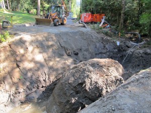
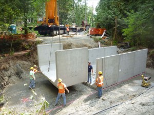
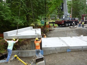
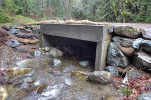
After delays to coordinate with patches on the upper couplet and the discovery of a surprisingly large rock, construction of the new culvert on the lower couplet is complete. Notice how deep the concrete culvert frame is and then how little is exposed above the water in the last picture. The bottom is filled with natural stream bed material so fish can pass through easily.

20130812CulvertCompleted01

Crews discovered a very large boulder that needed to be removed to install the culvert.

20130828CulvertCompleted02

Work crews guide the box culvert sections into place


20130828CulvertCompleted03

The work crew guides a cap onto the culvert sections

20140131CulvertCompleted04

The repaired culvert draining on a rainy winter day


Related Posts

Lower Couplet closure in July

Update July 24, 2013 – this work has been delayed

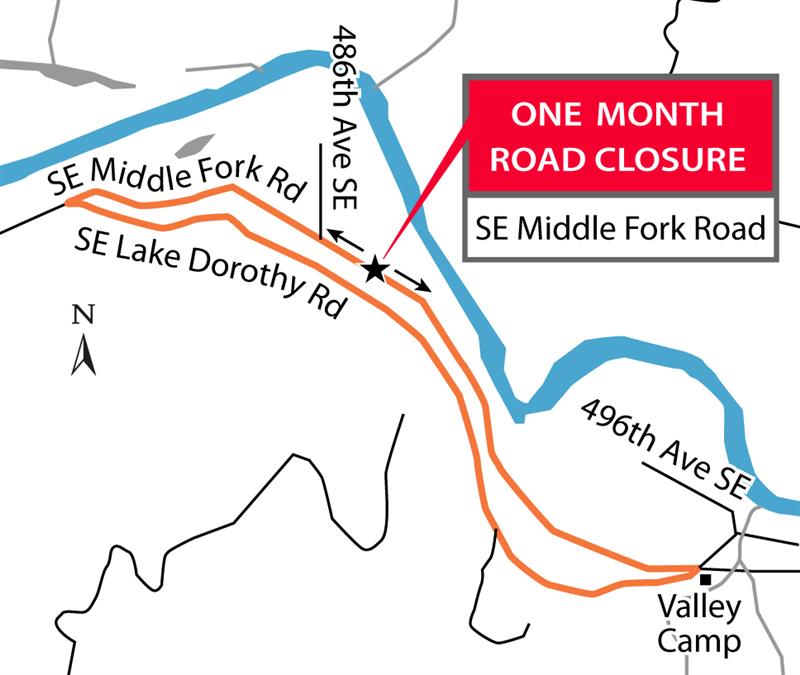
The lower portion of the couplet road (SE Middle Fork Road) will be closed from July 8 to August 2, 2013. King County is removing a deteriorating culvert and replacing it with a new fish passable one, including streambed gravel. This culvert scores high on the drainage priority list. Scouring is present at the culvert headwall, and the bottom is heavily corroded. The upper portion of the couplet, SE Lake Dorothy Road, will remain open for through traffic as a detour route.

Detour route

Detour route


Notice at couplet intersection

Notice at couplet intersection

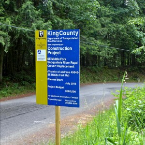
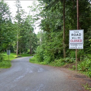
Notice at work site

Notice at work site

Weed Watcher Training

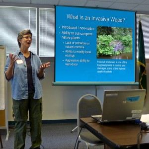
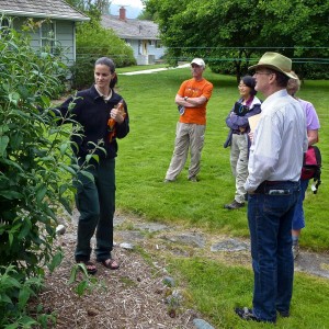
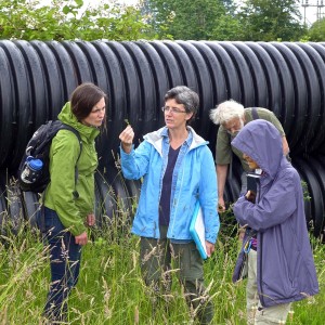
A room full of new and experienced weed watchers gathered at the North Bend ranger station on Sunday, June 23 for the annual King County noxious weed training program. The goal of this program is to train hikers to spot and report infestations of invasive species on public lands. Catching these areas early is key to preventing their spread, but there are far too many trails for the staff to monitor themselves. This year the Mountaineers joined forces, focusing on invasive species in Washington’s wilderness areas. For new comers, this training can be an overwhelming introduction because one weed looks pretty much the same as the next. However, by the end of the day everyone could probably distinguish a knotweed from a hawkweed. More information is available at the King County and Mountaineers weed watching sites.

Sasha Shaw, King County Noxious Weeds

Sasha Shaw, King County Noxious Weeds

Sasha Shaw, King County Noxious Weeds

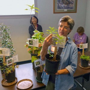
The dreaded butteryfly bush


Sarah Callaghan, Mt Baker-Snoqualmie National Forest

Sarah Callaghan points out an unusually large butterfly bush

Sasha Shaw, King County Noxious Weeds

What’s this weed?

Another mile graded

The road is getting better bit by bit. Another mile had gravel added and was graded today, making it a decent ride for the first 6.2 miles (2.5 of which are paved). This probably means King County will keep going for another 1.5 miles to the yellow gate. Hopefully the Forest Service will work on the last 5 miles to the Taylor Bridge soon — even one mile in the current condition is slow and hard on cars.

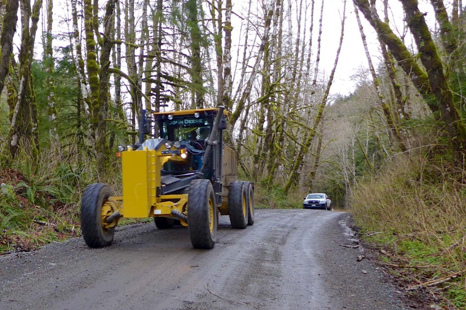
Grader on road

Grader returning after working on another mile of road just beyond the concrete bridge

Road graded to concrete bridge

During the first few months of 2013 the Middle Fork road has been as bad as it ever gets. There have been suspicions that maybe King County was conserving maintenance dollars because of the pending construction, but that doesn’t start for another year. However, in early March the road was graded and had gravel dumped on it as far as the concrete bridge at MP 5. Beyond that it’s still terrible, only getting slightly better after crossing the Taylor River and turning south to Dingford (still some snow on that section though, but driveable).

End of pavement before grading

End of pavement before grading

End of pavement after grading

End of pavement after grading

King County OKs paving

The King Countys DNS (Determination of NonSignificance) announcement follows the Federal Highway Administration’s FONSI (Finding of No Significant Impact), which was released in June, and is another necessary step before work gets underway. Gotta love those government acronyms! The document includes a slightly more concrete statement about when construction will occur.
20120731KingCountyDnsMap
“The project construction will take approximately 2.5 years between February and December subject to weather and timing restrictions to protect wildlife. It is anticipated that the project will be advertised in the fall of 2013 and that construction would begin in April 2014. The exact construction timing or schedule will be determined by the contractor.”

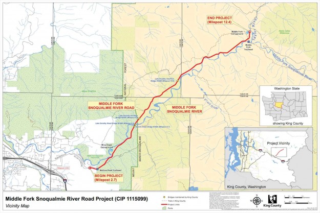
Nitpick: The indicated location of the three bridges to be? replaced are incorrect on this King County map. They are correct in the FONSI materials.