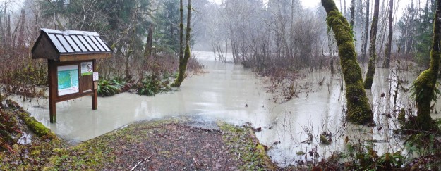
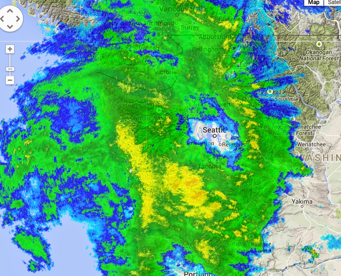
In early January the northwest was the recipient of another atmospheric river delivering moisture from the central Pacific. Cliff mass wrote “As much as 13 inches on the coast, with many locations getting 5-8 inches. But less than a quarter of an inch in the rain shadow over parts of Puget Sound and NW Washington. Big totals (4-6 inches) along the western slopes of the Cascades.” Rain gages in the North Bend area recorded over 4 1/2 inches of rain within a 24 hour period and the Middle Fork river responded with the 8th highest recorded flow to-date. Unfortunately the TANW1 gage, which is the only one that measures the Middle Fork in isolation failed midway through the event, but the last measured discharge* was 27,300 cfs at 11:15am, a couple hours after the rain had let up so the actual peak was likely close this value.
Flooded river access by Concrete Bridge
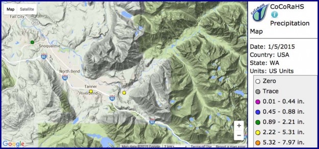
Precipitation map for Middle Fork area. The North Bend stations would eventually record 4 1/2 inches of rain on the morning of January 5.
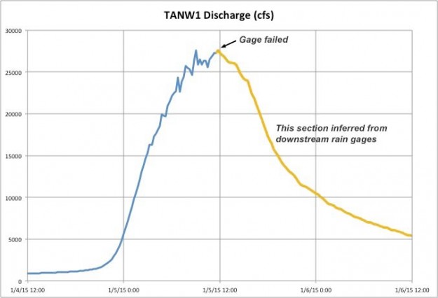
Discharge as measured by the TANW1 river gage. Unfortunately the gage failed midway through the storm so the rest of this graph was inferred as a proportionate estimate from downstream gages measuring the combined flow of all three forks.
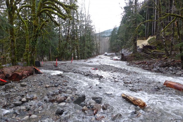
An event with such high flows would normally have serious consequences for the Middle Fork road. This time was unique in that the Middle Fork paving project had completed the first of three years of work with the last two miles of pavement completed including many new culverts for improved drainage. Most of the new work held up well to the extraordinary water flow levels but a few exceptions resulted in the road subsequently being closed until Memorial Day.
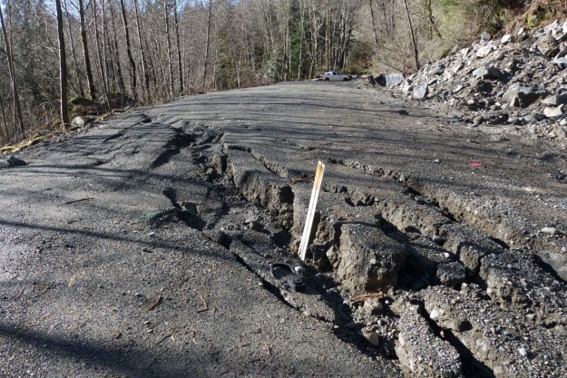
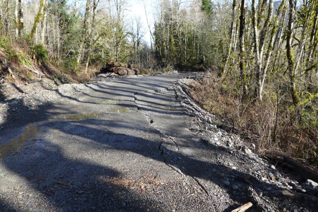
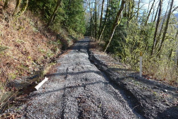
- The biggest problem was at the newly constructed box culverts at the stream crossings just beyond the CCC trail, otherwise known as Bessequartz Creek. The problems with this creek date back to a landslide on the southeast ridge of Bessemer in the 1998-2003 period that deposited a load of rocks into the drainage. With each major rain event the rocks were moved further downstream, first inundating the road during the massive 2009 flood. This current flood brought down enough rocks and logs to completely block one of the box culverts. The stream then overflowed the road, covering it with small boulders and forming new drainage channels across the recently reconfigured road bed.
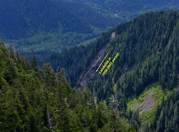
Old landslide scar visible on Bessemer’s southeast ridge
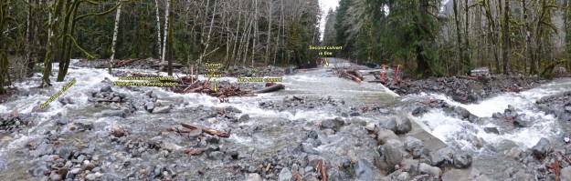
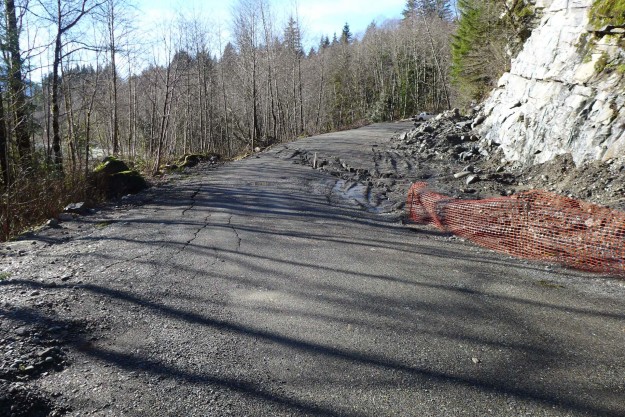
Bessequartz Creek washout
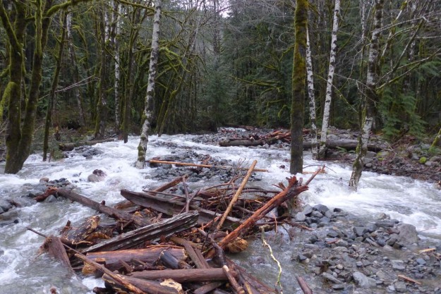
View up Bessequartz Creek showing the rocks and logs that have filled up the previous stream channel and blocked the box culvert. The stream should be draining directly under my feet.
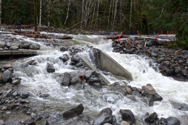
Almost no water is coming through the culvert because it’s blocked on the upstream end. The water has undercut the concrete slats.
View of the Bessequartz Creek washout from the upstream side
- A second major problem occurred just before the Bessequartz Creek crossing by the CCC trail junction where the road slumped because of a soft and unstable lens of clay under the road bed. The same area has been a problem in previous years as well. The paving plans call for a “deep patch” in this area which will reinforce the upper few feet but will not help with the underlying problem.
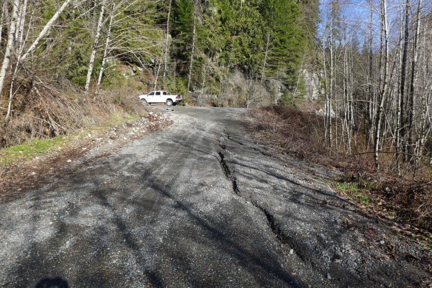
Small road slump and erosion approaching the CCC trail junction
Road slump by CCC trail junction
Road slump by CCC trail junction
- A third issue was a minor road slump just beyond the Bessemer road. This would later be addressed with another “deep patch” of the road bed.
Road slump just past the Bessemer road
- The road just past the Dingford turnoff up Hell Hill is frequently subjected to runoff and this was no exception.
Newly eroded gully on the road up Hell Hill
- The wash at the top of Hell Hill is used by the Forest Service as a source of gravel fill and they got a fresh supply delivered by Garfield Mountain. This time it partially covered logs stored there that were cleared from the right of way as part of the paving project.
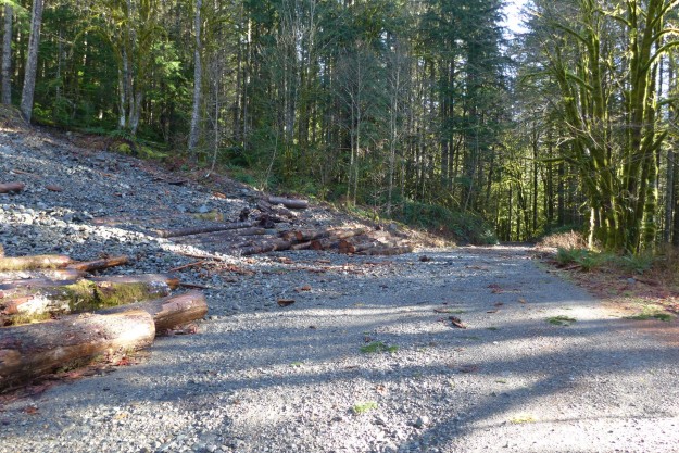
Garfield Mountain delivered a fresh round of gravel to the wash at the top of Hell Hill, covering the logs placed there from paving project clearing of the Middle Fork road.
These issues resulted in the closure of the road, ultimately until Memorial Day. The Forest Service’s Facebook announcement stated “The Mt. Baker-Snoqualmie National Forest is closing the Middle Fork Snoqualmie River Road (Forest Service road 56) for public safety until further notice. The road has recently experienced major storm damage making the road impassable. The Middle Fork Snoqualmie River Road will be closed at mile 2.2, near Valley Camp and Mailbox Peak Trailhead. At this time, Federal Highways Administration officials are determining how best to repair the road.”
Related News
- 01/04/2015 Cliff Mass Weather Blog – Serious Rain and Profound Rain Shadowing
- 01/06/2015 Christine Estrada – Goldmyer Hot Springs and forces of nature, a first hand account of being temporarily stranded far up the Middle Fork during this event
- 01/08/2015 SnoValley Star – City and citizens rise to the occasion
- 01/11/2015 Christine Estrada – Returning to Goldmyer
* Some time after the event, the USGS retroactively removed TANW1 raw data from the record back to midnight on January 5 because it could not be calibrated. Fortunately, we were able to capture that last morning of measurements and based on experience of observing other high water events it was close to reality even if not up to USGS standards.