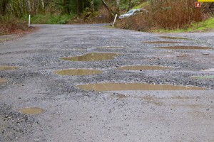
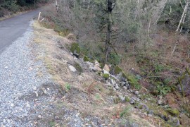
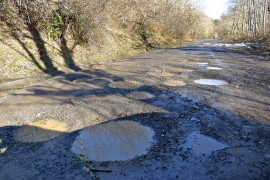
The closure of the lower couplet culvert has been delayed, and is now scheduled for August 5-30, 2013. The delay may be related to miscoordination with the the asphalt patching work on the upper couplet road in early July.
Category Archives: Middle Fork Road
Lower Couplet closure in July
Update July 24, 2013 – this work has been delayed
The lower portion of the couplet road (SE Middle Fork Road) will be closed from July 8 to August 2, 2013. King County is removing a deteriorating culvert and replacing it with a new fish passable one, including streambed gravel. This culvert scores high on the drainage priority list. Scouring is present at the culvert headwall, and the bottom is heavily corroded. The upper portion of the couplet, SE Lake Dorothy Road, will remain open for through traffic as a detour route.
Spring grading completed
The Forest Service graded the remainder of the Middle Fork road to Dingford during the first week of April, 2013. What was probably the worst pothole season ever has come to an end.
Smooth ride to Bessemer
The gravelled and graded road has been extended as far as the Bessemer Road at MP 7.3. Beyond that it’s pothole city to the Dingford turnoff.
Another mile graded
The road is getting better bit by bit. Another mile had gravel added and was graded today, making it a decent ride for the first 6.2 miles (2.5 of which are paved). This probably means King County will keep going for another 1.5 miles to the yellow gate. Hopefully the Forest Service will work on the last 5 miles to the Taylor Bridge soon — even one mile in the current condition is slow and hard on cars.
Road graded to concrete bridge
During the first few months of 2013 the Middle Fork road has been as bad as it ever gets. There have been suspicions that maybe King County was conserving maintenance dollars because of the pending construction, but that doesn’t start for another year. However, in early March the road was graded and had gravel dumped on it as far as the concrete bridge at MP 5. Beyond that it’s still terrible, only getting slightly better after crossing the Taylor River and turning south to Dingford (still some snow on that section though, but driveable).
Rock slide blocks road to Hardscrabble
Some time this spring as the upper Middle Fork Valley melted out, tons of rocks fell from cliffs just over a mile from the Hardscrabble trailhead. A few of the rocks are too large to be pushed or winched off the road, so blasting is planned for sometime in the first half of August, 2013. Expect both the road and Middle Fork trail beyond Goldmyer to be closed. The trail passes directly under the rock slide site so hikers and bikers would be in the line of fire of huge boulders rolling down the side of the valley.
Under the 2005 Access and Travel Management plan, the Forest Service is “required to perform all maintenance required on the segment used as a National Forest System trail.” In this case that probably means clearing enough rocks for a 40″ wide passage. Some of the inholder’s mining claims are beyond the rock slide, so they may assist with the cost of clearing a wider path to maintain access for vehicles. This rock slide is several miles beyond the Goldmyer turn-off, so access to the hot springs is not affected.
From 2005 ATM plan (emphasis mine) — Access to Mining Claimants on Road 5600
Mining Claimants will be given a key to the Dingford Creek gate and granted motorized access to their mining claims.
- They will not be required to perform maintenance, but will be allowed—at their choice and expense—to complete routine maintenance that will allow their continued motorized access. This will include cutting falling trees, removing rocks or brushing the private road/trail.
- If other than routine maintenance will be needed for their continued motorized access, claimants will first propose the work to the Forest Service, via either a notice of intent or a plan of operations related to their mining claims.
- Any work will be considered to be an integral part of their mining activity and will be process under the Forest Service’s mining regulations at 36 CFR 228, subpart A.
Paving project open house
Notes and materials from the previous open houses are posted on the paving project website, and not much new was presented at this meeting. However, the schedule is getting more definite:
- 2013: The project is anticipated to be awarded in the fall
- 2014: Active construction from late April through October
- 2015: Active construction from late April through October
- 2016: The actual paving will occur from late April through July
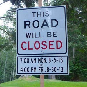
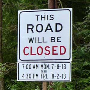
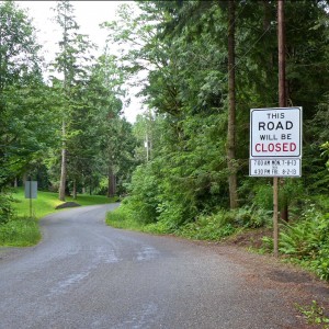
Construction will only take place between Monday’s at noon and end each week Friday at noon. During construction the Middle Fork Road beyond Valley Camp will be closed to all non construction vehicle traffic.
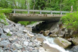
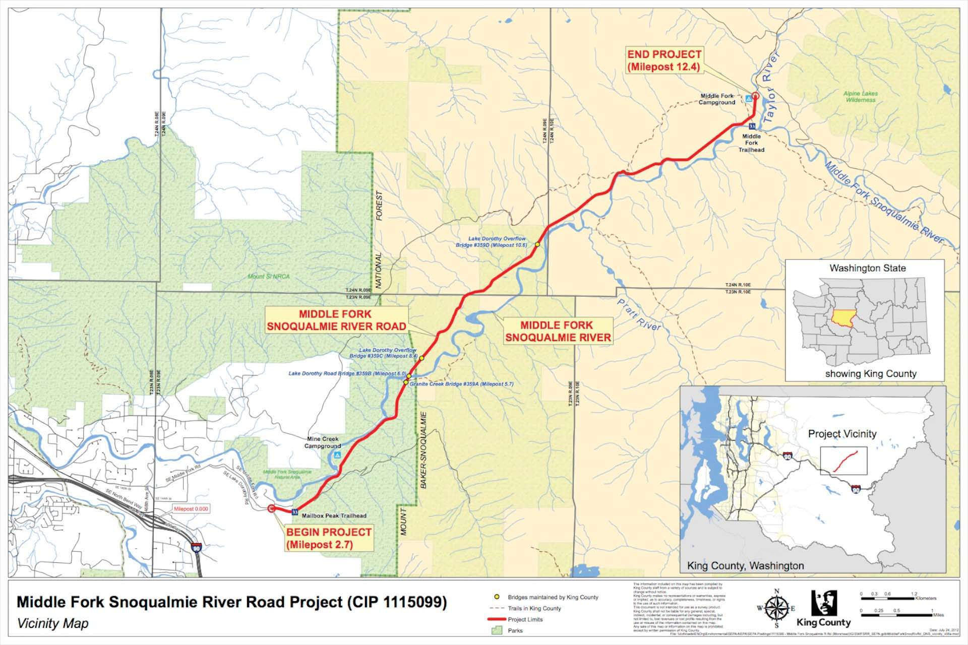
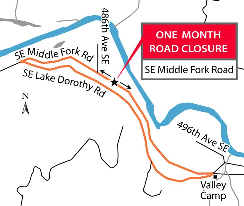
For an 8 week period during the summer of 2014 the Middle Fork road will be completely closed for a bridge replacement at mile post 10. During hours of construction the Lake Dorothy road will be closed to all non construction traffic to avoid accidents.Construction traffic will stay off the lower couplet road (SE Middle Fork). Once construction is complete the Lake Dorothy road (upper couplet road) will be repaired to the condition it was in prior to construction beginning. No upgrade or improvements will be done on either of the roads in the couplet area.
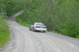
There was much discussion regarding slowing traffic down on the entire road length, access, traffic, and the exit 34 area. The design speed for the proposed project is 35 mph with an expected posted speed limit of 30 mph.
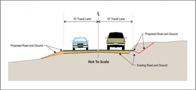
King County OKs paving
The King Countys DNS (Determination of NonSignificance) announcement follows the Federal Highway Administration’s FONSI (Finding of No Significant Impact), which was released in June, and is another necessary step before work gets underway. Gotta love those government acronyms! The document includes a slightly more concrete statement about when construction will occur.
“The project construction will take approximately 2.5 years between February and December subject to weather and timing restrictions to protect wildlife. It is anticipated that the project will be advertised in the fall of 2013 and that construction would begin in April 2014. The exact construction timing or schedule will be determined by the contractor.”
Nitpick: The indicated location of the three bridges to be? replaced are incorrect on this King County map. They are correct in the FONSI materials.
Toyota Misses The Turn
Driving too fast on the Middle Fork road can quickly turn a great day in the mountains into a nightmare. This particular accident didn’t need to happen. The vehicle didn’t make the turn at the most dangerous spot on the road at MP 6.7, skidded off the side and turned at least once before coming to rest right side up in the gully. This incident did not make the news so my assumption is that no-one was seriously hurt or killed. Keep your speed down!