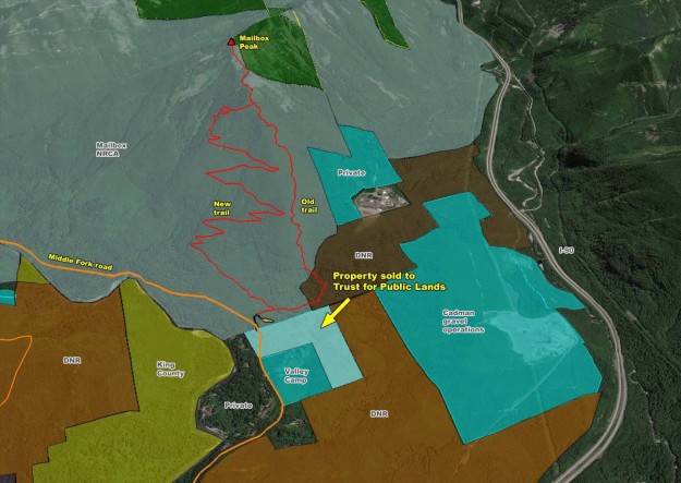
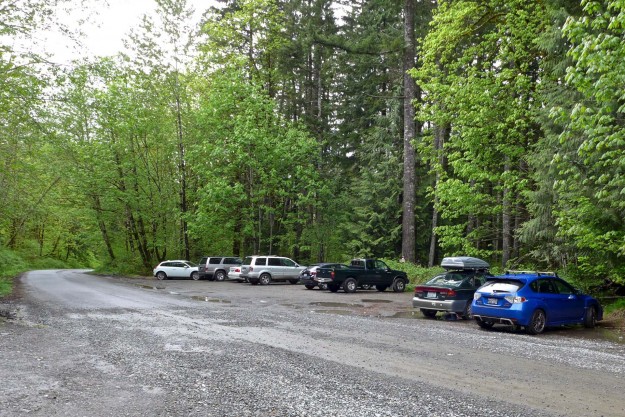
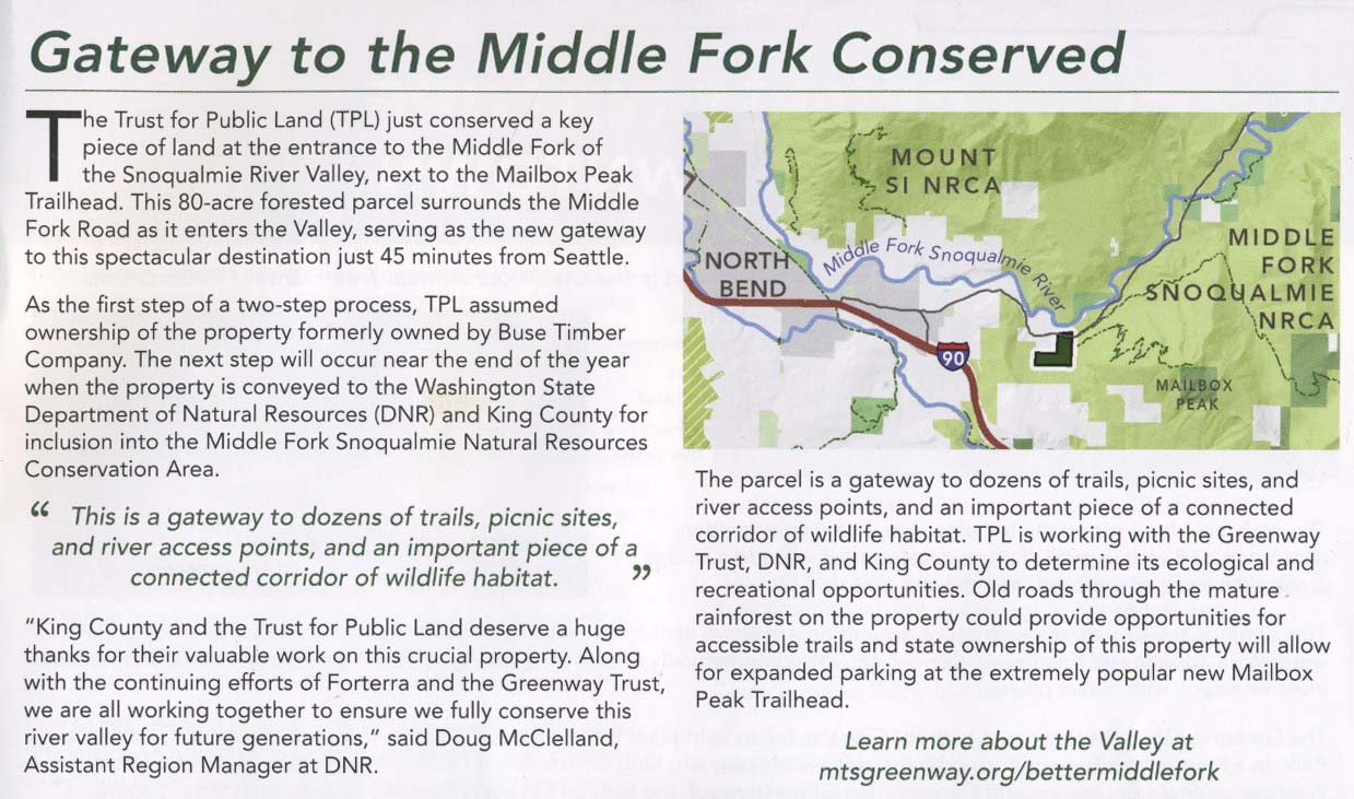
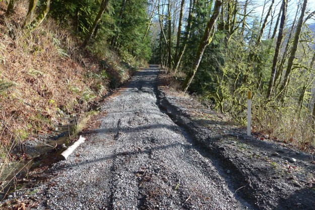
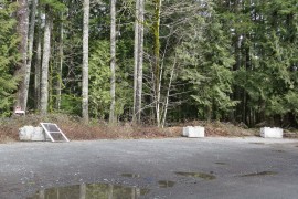
An earlier post described potential parking problems across the road from the Mailbox Peak trailhead shortly after a new trailhead was constructed. Today, the DNR announced that they had successfully negotiated a purchase of the five parcels of land including the disputed parking pullout and other parcels surrounding Valley Camp. While there have not been problems reporting by hikers parking in the pullout north of the road the “No Trespassing” and “Private Property” signs were unnerving. This pullout provides overflow parking when the lot up the hill is full or for hikers who get a late start and might get down after the gate is locked.
Property purchased by Trust for Public Land that will extend the boundaries of the Mailbox Peak NRCA when transferred to the DNR
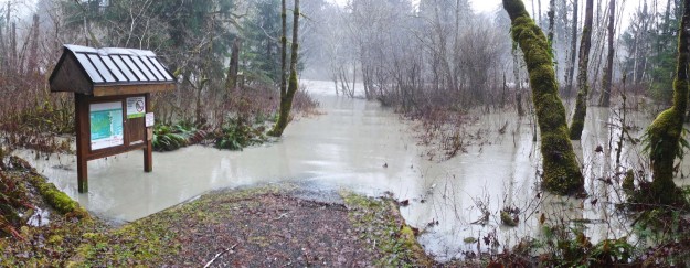
Mailbox Peak overflow parking on north side of road
According to county records, the property was purchased in August, 2015 by the Trust for Public Lands for $1.4 million. The deal was delayed for years because the seller was not satisfied with the amount being offered by the DNR, saying that it was substantially less than the assessed value he was taxed on — $1.643 million for 2015. The title is expected to be transferred to the DNR in January, 2016 but King County will retain the development rights. It’s good news that the parties were able to come to an agreement as the seller recently cleared old logging roads on the property so potential private buyers could inspect the parcels for sale. This is also good news for Valley Camp which will continue to be surrounded by undeveloped property.
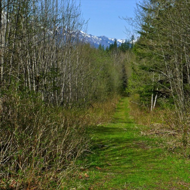
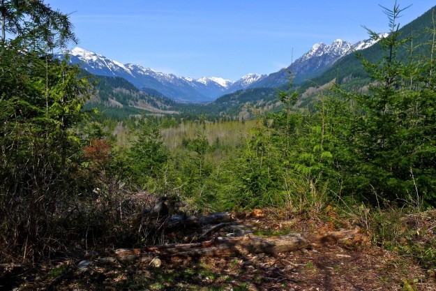
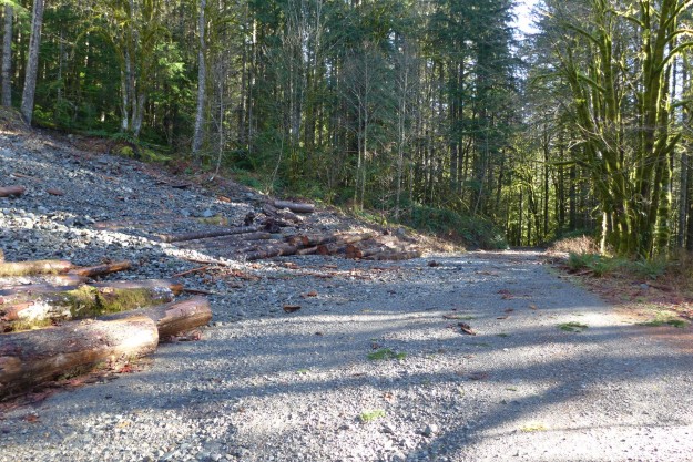
The announcement states that the DNR and others are “exploring options for the property, possibly by restoring roads and access points remaining from timber harvesting as the basis for establishing ADA-friendly trails. This purchase also enables DNR to provide better access and amenities for those coming to hike Mailbox Peak.” It may take a while to realize those ambitions, but the area is already worth a side trip as part of a visit to Mailbox Peak. Most of the old logging roads in the lower areas are excellent for walking with one leading to an old yarding area known as Greg’s Valley View Point. There are no detailed maps of this area so navigational aids such as a GPS are recommended. Please respect Valley Camp’s property and exit via the Mailbox trailhead road.
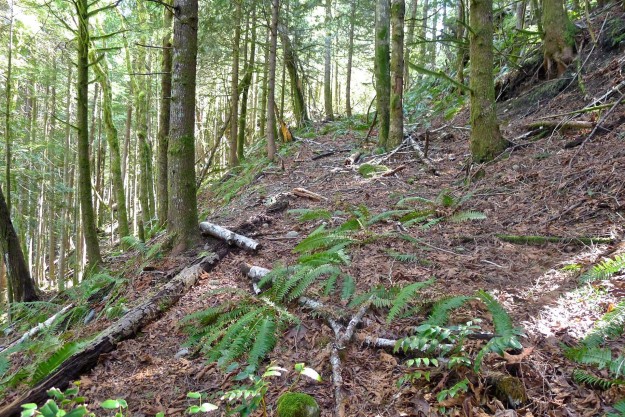
Spring growth on lower Grouse Ridge road
Greg’s Valley View Point
Some of the old logging roads climbing Grouse Ridge could be easily converted to hiking trails
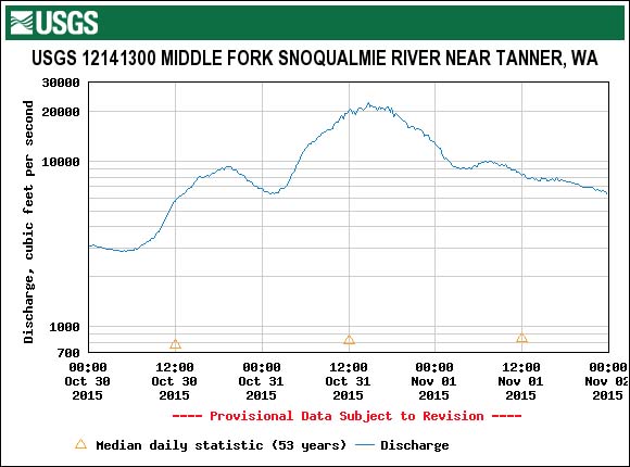
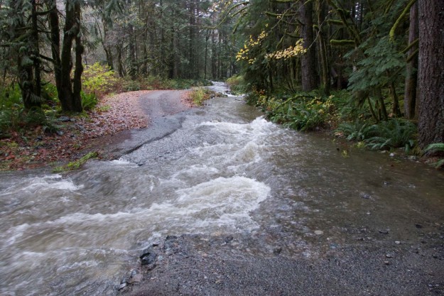
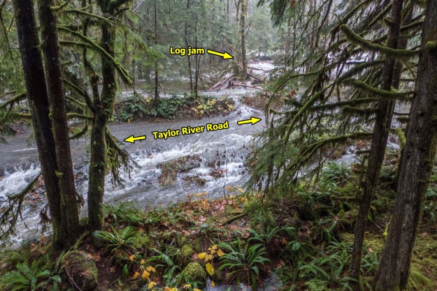
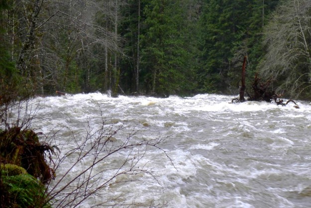
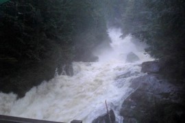
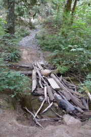
A heavy rain storm on Halloween weekend that dropped 4 1/4 inches of rain over 2 days resulted in a peak flow of 22,400 cfps on the Middle Fork river. The rain was steady without a heavy downpour at any one time and there was no snow to melt in the mountains, factors which helped avoid major damage to the road. But flows of ~20,000 cfps were sustained for 5 hours. The Taylor river was especially wild — a log jam formed just above the turn off to Dingford Creek and caused part of the river to flow over the spur to the Taylor River trailhead. Later reports indicate that SUV style vehicles should still be able to negotiate the trench eroded across the road (see the last photo below).
The Taylor River overflowed it’s banks and ran across the spur road to the trailhead in two places.
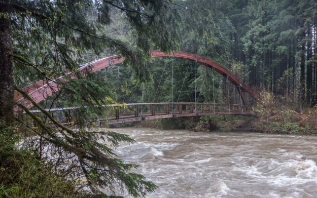
Gateway Bridge still safely above the water
The log jam at the top of the picture restricted the flow of the Taylor River causing water to flow across the road
The log jam is at the left of this picture in front of the tree island. The tree with the huge root ball on the right came down the river while I was standing here.
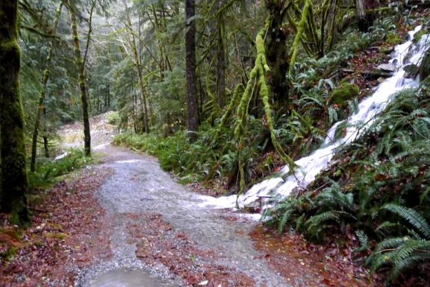
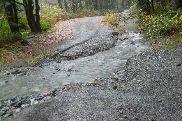
A creek flowing down an unusual spot along the road to the Dingford Creek trailhead. Normally this water would come down the drainage in the background.
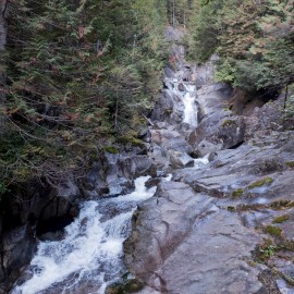
Dingford Creek falls from the bridge. The spray was so intense it was impossible to get a clear shot.
Compare to flow level in late summer
Taylor River trailhead washout on November 1 after the high water receded. Photo by Bill Davis.
Related stories
Cliff Mass Weather Blog – Serious Precipitation and Flooding is Probable During the Next 72 Hours
Living Snoqualmie – Heavy Rain, Wind Roll into Snoqualmie Valley; River Rising, Flood Warning, Wind Advisory Issued
SnoValley Star – County issues Phase III flood alert for Snoqualmie River
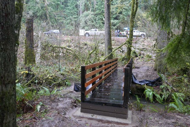
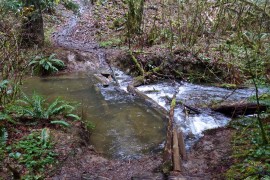
This week the DNR installed a new bridge over Mine Creek at the Island Drop* kayak launch. This is part of the implementation of the Snoqualmie Corridor Recreation Plan approved in March 2015.
December 9, 2015 update: The railing on the new bridge was damaged by a tree falling across it during an early December storm.
New Mine Creek bridge
New Mine Creek bridge. Kayakers in background are preparing to put in.
Project description on other side: To construct a trail bridge across Mine Creek to access a kayak put-in spot in an eddy on the Middle Fork Snoqualmie River
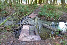
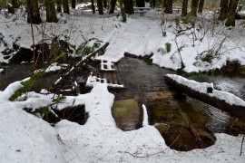
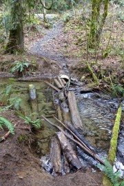
While the creek is not large and most of the year it’s easy to simply step across it, especially by kayakers prepared to be fully immersed in the river, it regularly accumulated a haphazard assembly of logs and other debris to make the crossing easier. That should not be a problem now except when the river is at flood stage and the whole Mine Creek area is under water (see Jan 2015) photo below.
Mine Creek crossing, Feb 2011
Mine Creek crossing, Jan 2012
Mine Creek crossing, Jan 2014
Mine Creek crossing, Nov 2014
Mine Creek crossing, Jan 2015 flood
Mine Creek crossing, May 2015
Mine Creek crossing, Aug 2015
Reference: Snoqualmie Corridor Recreation Plan PDF document
* The name Island Drop was originated by kayakers before 2006 when there was an island in the river just above the bend by the road. It was completely washed away in the November 2006 flood. Perhaps a better name is appropriate 10 years later.
REI web page with final Middle Fork Snoqualmie River Trail totals
As part of it’s “Every Trail Connects” campaign, REI invited its members and the outdoor community across the country to have a direct effect on the trails they love. Community votes determined how to invest $500,000 with 10 nonprofit partners to support 10 selected trails including the Middle Fork Trail on the Snoqualmie River. Each vote (one per day, per person) meant a $5 investment in the selected trail. The investment is part of $5.9 million that REI is granting in 2015 to more than 300 nonprofits working to create access to more than 1,000 outdoor places throughout the United States.
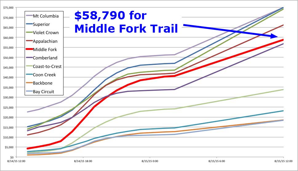
Because of the 3 hour time zone difference with the east coast, the Middle Fork Trail got off to a slow start, but as word spread on local hiking sites and social media the votes started coming in at a brisk pace. Ultimately, the Middle Fork trail got the 5th highest vote total, just 3,242 votes shy of the maximum 15,000. After the voting was done REI added a $10,000 bonus to each of the 10 trails, raising the total to $68,790.
Progress of voting during REI Every Trail campaign
The funds will help repair multiple washouts on the Middle Fork Trail from the severe November 2006 and January 2009 floods and reroute a section located on a rapidly migrating river bend to higher ground. The project also includes removing approximately 0.5 miles of washed-out trail segments to promote natural re-vegetation and repairing portions of the damaged wood boardwalks. Unfortunately, it’s not enough money to add a badly needed bridge at the Thunder Creek crossing. The work will be done through a partnership with the Mountains to Sound Greenway Trust and Washington Trails Association.
The unfunded 2012 PRISM Project #12-1743 details much of the work that has been deferred due to lack of funds. The plans for the reroute were published by the USFS as SOPA Project 94062 in July, 2013.
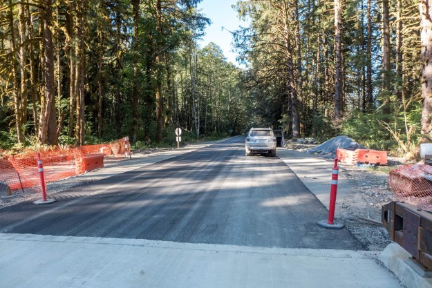
2 more miles of the Middle Fork road were paved in early August, 2015 between the Big Blowout Creek and MP 10.6 bridges. This video was taken the first weekend after the paving was completed.
Big Blowout Creek crossing with new pavement starting from the far end of the bridge
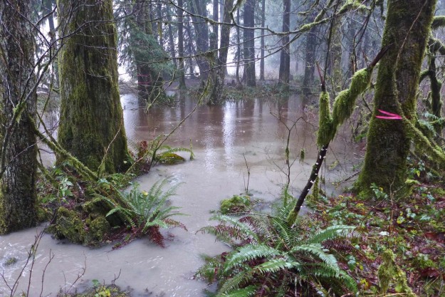
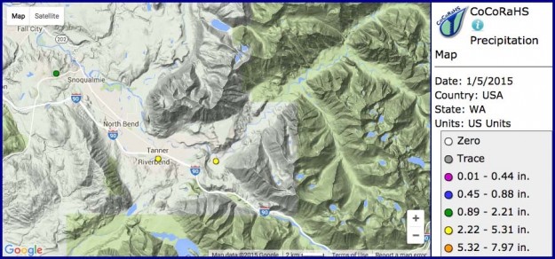
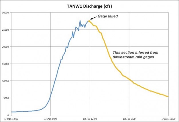
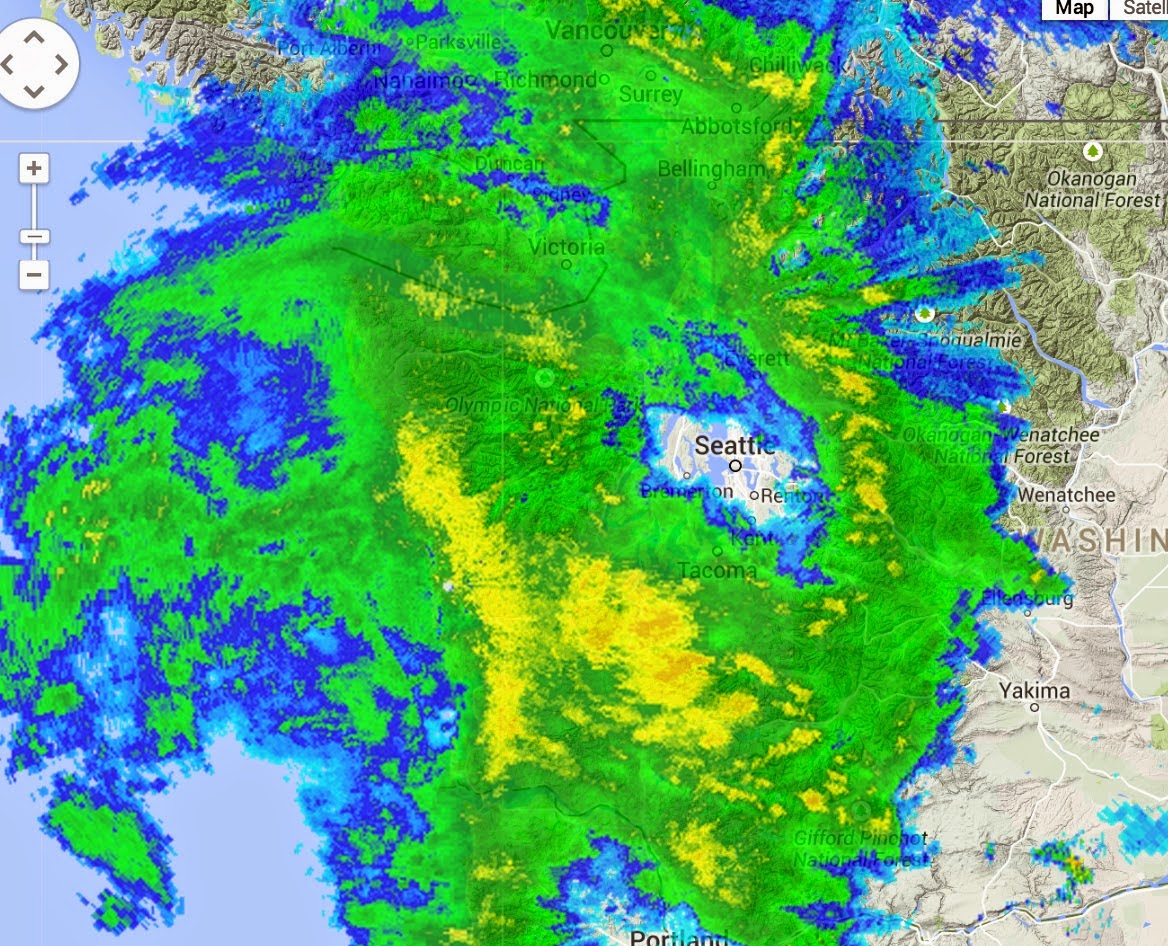
In early January the northwest was the recipient of another atmospheric river delivering moisture from the central Pacific. Cliff mass wrote“As much as 13 inches on the coast, with many locations getting 5-8 inches. But less than a quarter of an inch in the rain shadow over parts of Puget Sound and NW Washington. Big totals (4-6 inches) along the western slopes of the Cascades.” Rain gages in the North Bend area recorded over 4 1/2 inches of rain within a 24 hour period and the Middle Fork river responded with the 8th highest recorded flow to-date. Unfortunately the TANW1 gage, which is the only one that measures the Middle Fork in isolation failed midway through the event, but the last measured discharge* was 27,300 cfs at 11:15am, a couple hours after the rain had let up so the actual peak was likely close this value.
Flooded river access by Concrete Bridge
Precipitation map for Middle Fork area. The North Bend stations would eventually record 4 1/2 inches of rain on the morning of January 5.
Discharge as measured by the TANW1 river gage. Unfortunately the gage failed midway through the storm so the rest of this graph was inferred as a proportionate estimate from downstream gages measuring the combined flow of all three forks.
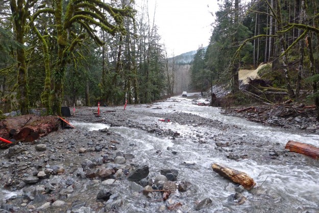
An event with such high flows would normally have serious consequences for the Middle Fork road. This time was unique in that the Middle Fork paving project had completed the first of three years of work with the last two miles of pavement completed including many new culverts for improved drainage. Most of the new work held up well to the extraordinary water flow levels but a few exceptions resulted in the road subsequently being closed until Memorial Day.
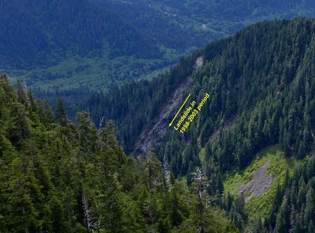
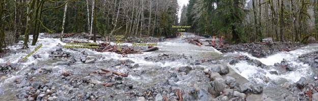
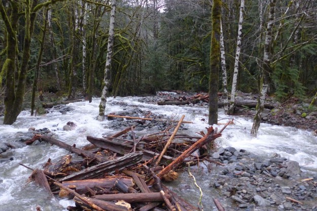
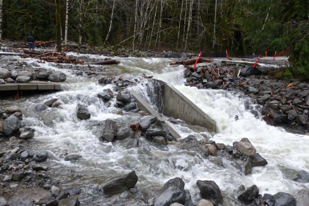
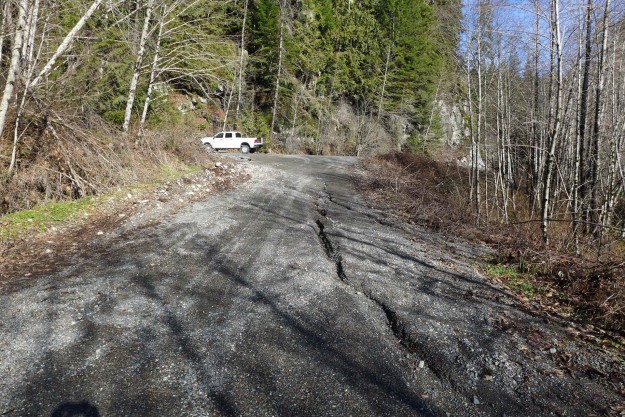
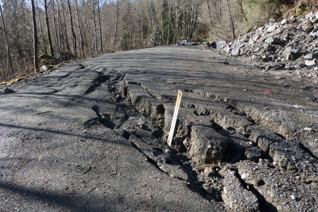
The biggest problem was at the newly constructed box culverts at the stream crossings just beyond the CCC trail, otherwise known as Bessequartz Creek. The problems with this creek date back to a landslide on the southeast ridge of Bessemer in the 1998-2003 period that deposited a load of rocks into the drainage. With each major rain event the rocks were moved further downstream, first inundating the road during the massive 2009 flood. This current flood brought down enough rocks and logs to completely block one of the box culverts. The stream then overflowed the road, covering it with small boulders and forming new drainage channels across the recently reconfigured road bed.
Old landslide scar visible on Bessemer’s southeast ridge
Bessequartz Creek washout
View up Bessequartz Creek showing the rocks and logs that have filled up the previous stream channel and blocked the box culvert. The stream should be draining directly under my feet.
Almost no water is coming through the culvert because it’s blocked on the upstream end. The water has undercut the concrete slats.
View of the Bessequartz Creek washout from the upstream side
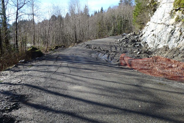
A second major problem occurred just before the Bessequartz Creek crossing by the CCC trail junction where the road slumped because of a soft and unstable lens of clay under the road bed. The same area has been a problem in previous years as well. The paving plans call for a “deep patch” in this area which will reinforce the upper few feet but will not help with the underlying problem.
Small road slump and erosion approaching the CCC trail junction
Road slump by CCC trail junction
Road slump by CCC trail junction
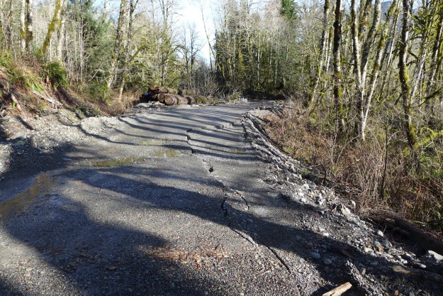
A third issue was a minor road slump just beyond the Bessemer road. This would later be addressed with another “deep patch” of the road bed.
Road slump just past the Bessemer road
The road just past the Dingford turnoff up Hell Hill is frequently subjected to runoff and this was no exception.
Newly eroded gully on the road up Hell Hill
The wash at the top of Hell Hill is used by the Forest Service as a source of gravel fill and they got a fresh supply delivered by Garfield Mountain. This time it partially covered logs stored there that were cleared from the right of way as part of the paving project.
Garfield Mountain delivered a fresh round of gravel to the wash at the top of Hell Hill, covering the logs placed there from paving project clearing of the Middle Fork road.
These issues resulted in the closure of the road, ultimately until Memorial Day. The Forest Service’s Facebook announcement stated “The Mt. Baker-Snoqualmie National Forest is closing the Middle Fork Snoqualmie River Road (Forest Service road 56) for public safety until further notice. The road has recently experienced major storm damage making the road impassable. The Middle Fork Snoqualmie River Road will be closed at mile 2.2, near Valley Camp and Mailbox Peak Trailhead. At this time, Federal Highways Administration officials are determining how best to repair the road.”
01/06/2015 Christine Estrada – Goldmyer Hot Springs and forces of nature, a first hand account of being temporarily stranded far up the Middle Fork during this event
* Some time after the event, the USGS retroactively removed TANW1 raw data from the record back to midnight on January 5 because it could not be calibrated. Fortunately, we were able to capture that last morning of measurements and based on experience of observing other high water events it was close to reality even if not up to USGS standards.
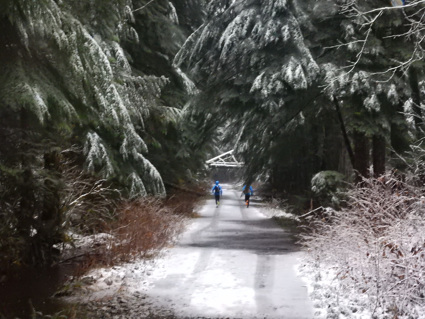
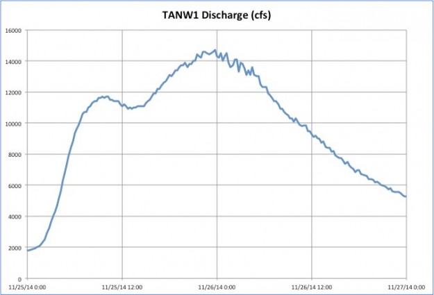
Video clips from a high water event two days before Thanksgiving on November 25, 2014. No damage was done by this storm because the peak flow was only 14,700 cfs.
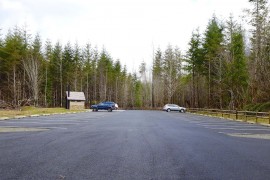
The last 2 miles of the Middle Fork road were paved in early October, 2014 from the MP 10.6 bridge to the Taylor River campground. The Middle Fork trailhead parking areas were paved at the same time.
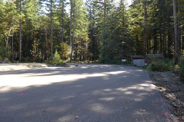
Middle Fork trailhead prepped for paving
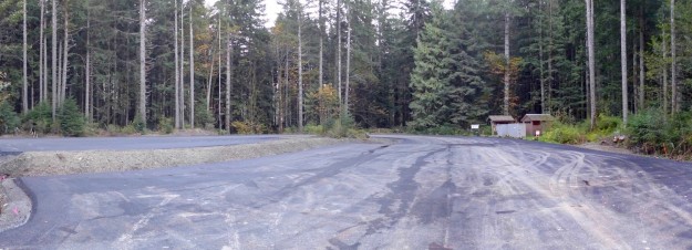
Middle Fork Trailhead parking lot paved (from construction newsletter, courtesy of ACI)
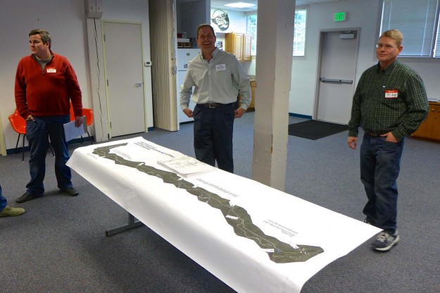
A paving project open house was held at the North Bend Ranger Station on April 23, 2014. Several engineers from the WFLH and a representative of the contractor were present to answer questions. The event was more lightly attended than previous events, possibly because most of the decisions have already been made. This attendee put in a request to rationalize the milepost marks by starting them at the intersection of the Middle Fork Road and 468th Ave SE instead of I-90 Exit 34.
North Bend Ranger Station, the open house venue
WFLH project engineers available to answer questions
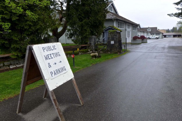
As of Friday, March 7, 2014 the Mailbox peak parking lot will be open each Friday, Saturday and Sunday. At the same time the concrete gabions with a “No Parking” message in the pullout north of the road were turned around. Is it ok to park here now? Probably not — no agreement has been reached between the DNR and the property owner so if the gate is closed or the parking lot is full you are better off parking on the south (gate) side of the road if there’s room, or along the road.