Tag Archives: DNR

Blethen Lake property purchased for Mt Si NRCA

In January, 2017, Forterra announced the purchase of two large parcels of land from the Cugini family, one of which includes the Blethen Lakes. These small lakes are the headwaters of Quartz Creek which drains into the Taylor River just above the confluence with the Middle Fork Snoqualmie river. According to Forterra, the DNR and other conservationists, work on this deal has been going on for 15 years and only now has come to fruition as the parties involved agreed on a fair appraisal value that considered the full value of the timber on the property. The price for the Lake Blethen property was $895K, with the funding coming from contributions and the Land and Water Conservation Fund via the US Fish and Wildlife Service.

20110924BlethenLakesFromBessemer

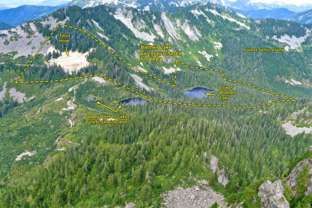
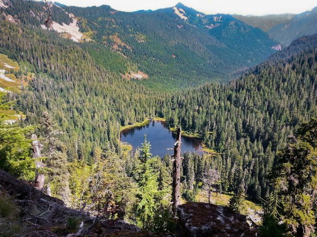
Blethen Lakes from Bessmer. The purchased land includes lower Blethen Lakes. The surrounding property is either in the DNR’s Mt Si NRCA or part of the Mt Baker-Snoqualmie National Forest. Mining of talus rock will presumably stop now.

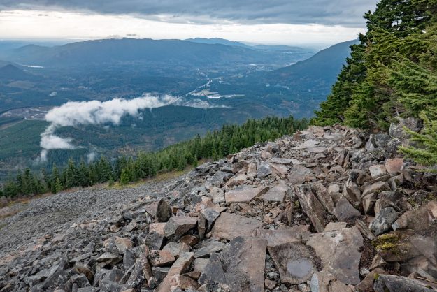
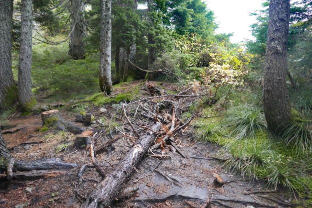
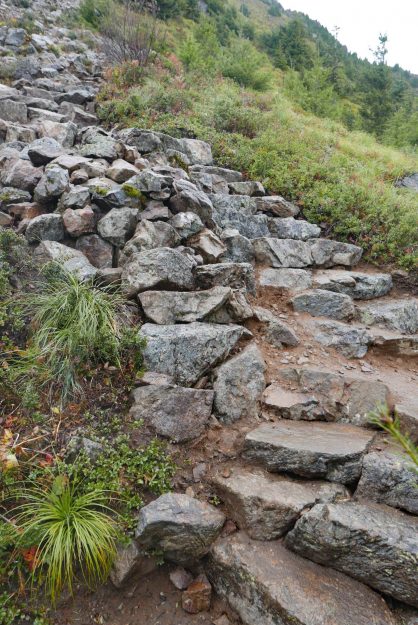
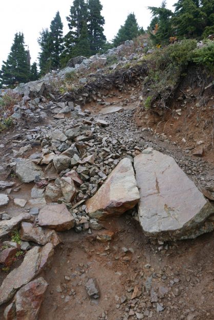
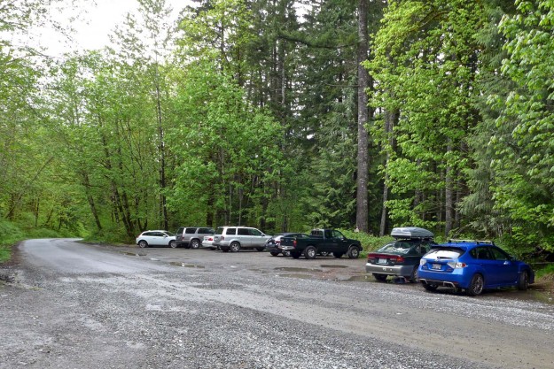
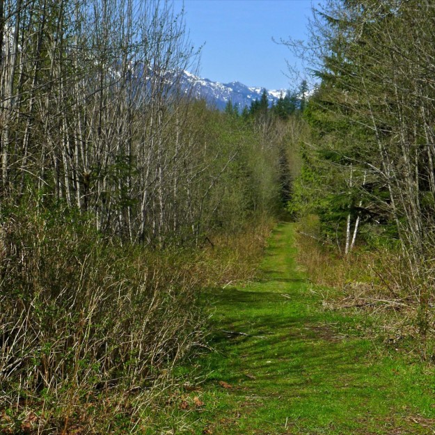
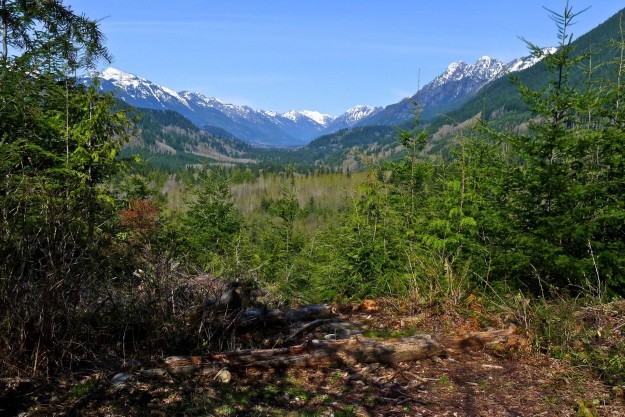
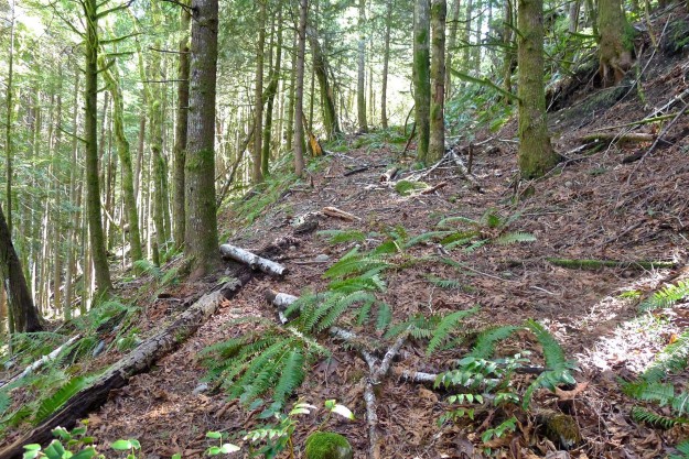
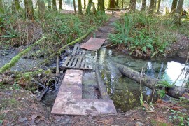
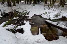
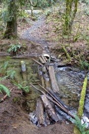
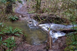
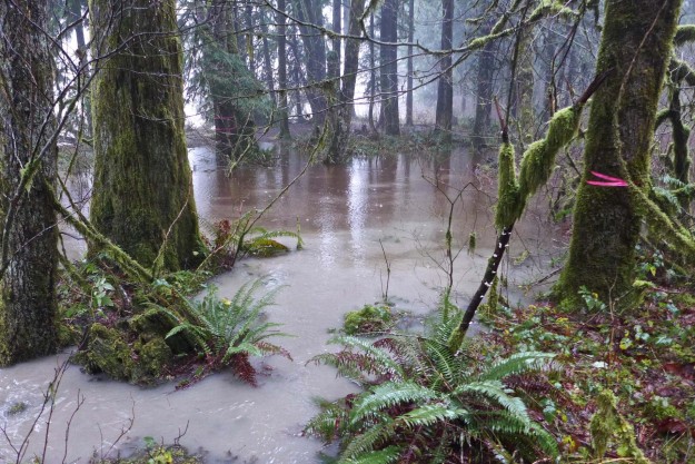
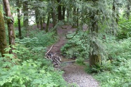
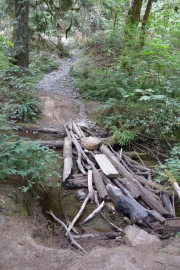
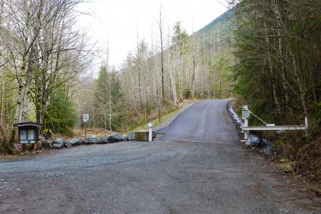
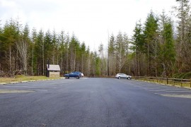
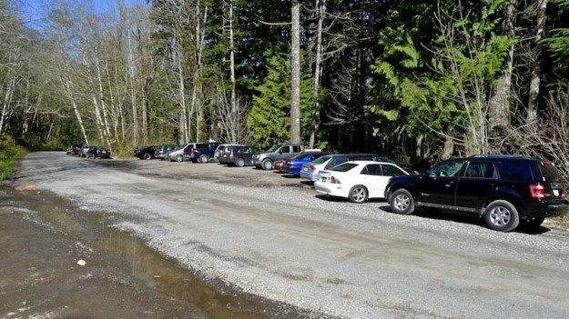
Blethen Lake is difficult to get to. One choice is to purchase a Campbell non-motorized pass and walk or bike the 11 miles (each way) of logging roads from the Spur 10 gate to the pass between Hancock and Quartz Creek. A shorter route is to start at the Taylor River trailhead in the Middle Fork valley and walk up the old Quartz Creek road. Unfortunately, this has become increasingly overgrown over the years and several of the old bridges have been washed out leaving deep gullies, one of which is quite difficult to cross. Volunteers did some trail clearing in 2016 so it may be slightly better now. The old road/trail ends about 3/4 of a mile before you reach the lake. There are rumors of an old trail, but most people who reach the lake these days do so as a winter snowshoe trip to avoid the brush.

20150531BlethenLakesFromPaperboy

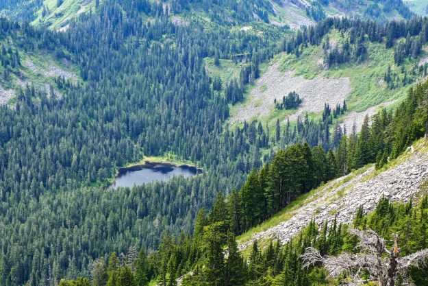
Blethen Lakes from Paperboy. The upper lake is barely visible at the Quartz/Hancock Creek saddle.

20170303BlethenLake

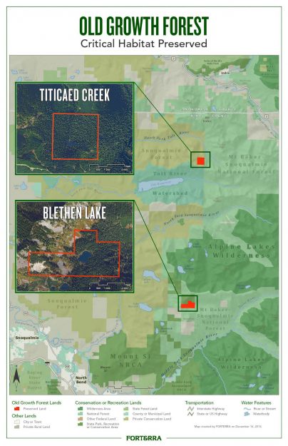
Forterra map of the purchase included in their press release. The Blethen Lake and Titicaed Creek parcels were 220 and 156 acres respectively.

20170103FoterraFB

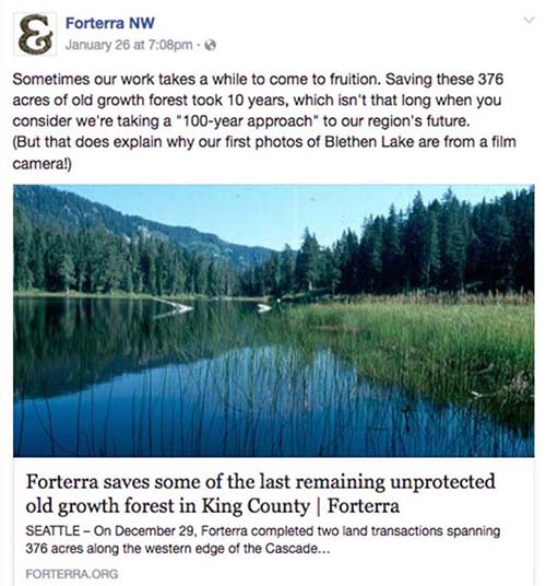
Forterra Facebook post

20160909LakeBlethen

Lower Lake Blethen – Courtesy of Robert Cugini

GrandpaCugini

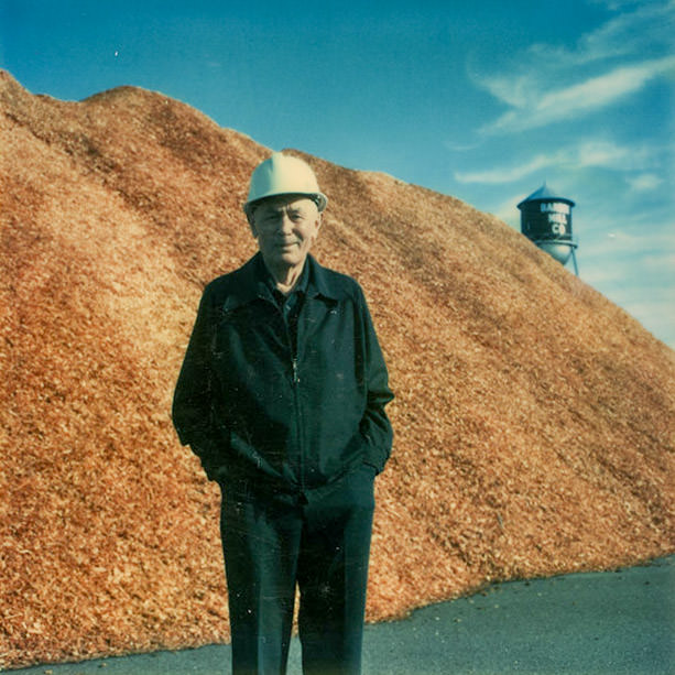
Alex Cugini Sr. in an undated photo – Courtesy of Robert Cugini

Related links

  • 01/03/2017 Forterra press release – Forterra saves some of the last remaining unprotected old growth forest in King County
  • 01/05/2017 Snoqualmie Valley Record – Forterra and DNR buy 376 acres near North and Middle Forks
  • 01/03/2017 nwhikers.net trip report – Blethen lake via Quartz Creek Road
  • 04/23/2011 nwhikers.net trip report – Boomerang and Paperboy from Spur 10 gate
  • 03/28/2010 Hiking With My Brother – Blethen Lakes – Quartz Creek Trail #1263
  • 10/27/2016 Recreation and Conservation Office project 16-1439 – Department of Natural Resources grant proposal to buy 891 acres in east King County. This proposal includes other parcels besides the ones mentioned above, but has a tantalizing suggestion from ALPS that a trail to Blethen Lake may be a possibility in the future.

    DNR: 632 acres in the Mount Si Natural Resources Conservation Area, 179 acres in the Middle Fork Snoqualmie Natural Resources Conservation Area, and 80 acres in the Rattlesnake Mountain Scenic Area. The land includes key areas in the Mountains to Sound Greenway that are threatened by residential development and provide crucial wildlife habitat in an urban area. … Distinctive features include talus, high and low elevation lakes, numerous streams, wetlands, old-growth and mature forests, cliffs, and landscape connections for wildlife. Wildlife at these sites include a variety of animals, including cougars, bobcats, mountain goats, black bears, coyotes, elk, red-tailed hawks, osprey, barred owls, pygmy owls, and pileated woodpeckers. The department will allow low-impact public use and outdoor environmental education on the land.

    ALPS: Lake Blethen also holds old growth forests, with some very old and impressive western red cedars. It might possibly make a good destination for a new trail in future. And all the other parcels identified by DNR have outstanding values which will only increase as time passes and this area becomes more and more the focus for people seeking to escape Seattle to someplace wild and natural.

Mailbox summit trail spares trees

The DNR has been building the new Mailbox Peak trail for several years and it’s nearly complete. Work on the lower switchbacks began in 2012 using a small excavator while another crew worked by hand down from the top. A new parking lot was built in 2013 and by the end of that year the new trail connected with the old trail at 3900′, just below the big talus field. Work continued in succeeding seasons to add bridges, improve drainage at smaller creek crossings, and improve the tread.

In 2016 most of the work was focused on the section of trail through the talus field and continuing on an open ridge to the summit. The old trail alignment veered to the north side of the ridge line and passed through a grove of old growth hemlock trees. They were beautiful and stately, but the impact of thousands of boots stepping on the trail that was in large part roots of these trees threatened their health. Heavy duty rock work was required to construct trail switchbacks through the talus, but this trail will melt out sooner in the spring and is indestructible. Above the talus the tread is now restricted to a single path instead of multiple braids, and much of it has been improved with sturdy rock steps. Previously this was an erosion-prone dirty gully with rocks continually working loose from boot traffic.

Only a short section remains before the new Mailbox trail is completed, and we can expect that to occur in 2017.

20161025NewMailboxTrailThroughTalus

Illustration of work done on this year on the upper section of the new Mailbox trail. The work on the final section to the summit is not complete yet.

20161025Mailbox01

Junction of the new and old trails. The new trail now goes straight ahead instead of steeply up to the left.

20161025Mailbox02

Easy section just past the new/old trail junction

20161025Mailbox03

New switchback on the south side below the talus field

20161025Mailbox04

The new trail enters the talus field on the south side of the ridge. This avoids the rooty trail through the old growth hemlocks which would have harmed them over time.

20161025Mailbox05

New trail through talus

20161025Mailbox11

Building a trail through the talus field. Photo courtesy of DNR.

20161025Mailbox06

The crew did a great job laying flat stepping stones here

20161025Mailbox07

This is the top of talus trail section where the trail leaves the talus field

20161025Mailbox08

The blocked old trail from the other side of the blockage. There’s no reason for anyone to go this way now — the talus field has big views and secure footing.

20161025Mailbox09

Well done rock step work where it used to be semi-loose rocks in a dirty gully

20161025Mailbox10

Obviously this is beyond the point that the trail crew got to. This is what much of the ridge trail used to look like.

Comment period opens for Teneriffe trailhead

The DNR has released detailed project materials for a proposed new Teneriffe trailhead along the Mount Si road. The SEPA documents are available on the project’s web page and comments should be submitted by Sunday, July 24, 2016. The planed site is not at the school bus turn-around, but at a location closer to the Mount Si trailhead. The plan is very similar to the one discussed at the public forum in January, 2016

Update: In mid-August the DNR released the Notice of Final Determination for the Teneriffe parking lot project. Comments were generally positive but with concerns similar to those that came up in the public forums.

20160628ProposedTeneriffeParkingMap

Proposed Mount Teneriffe Trailhead location


20160628ProposedTeneriffeParkingPlan

Proposed Mount Teneriffe Trailhead – Site Plan (Draft for planning purposes only)

DNR hosts Teneriffe trailhead forum

On January 26, 2016 the local DNR staff hosted a neighborhood forum to discuss early stage plans for a new trailhead at the base of Mount Teneriffe. The DNR had previously met with selected neighbors and scheduled a previous forum that was lightly attended because a strong windstorm hit the area that day. This event drew about 40 people, the higher attendance probably due to an article about the meeting in a local newspaper.

20160126TeneriffeTrailheadPlans01

Neighbors filter in as the DNR staff prepares to start the meeting

After a brief overview, Doug McClelland of the local DNR office fielded questions and concerns from the audience for over an hour and half. Doug emphasized that the DNR is not trying to draw more recreation related traffic up the narrow SE Mount Si Road, rather it is trying to solve a problem of inadequate parking at the school bus turn-around as the Mount Teneriffe trails become more popular. This Mount Si NRCA project is only one part of a comprehensive Snoqualmie Corridor Recreation Plan including DNR lands on Tiger Mountain, the Raging River valley, Rattlesnake Mountain, and the Middle Fork Snoqualmie NRCA. Most of the trailheads being developed are close to I-90 and do not involve hikers walking or driving through a residential area. That makes this trailhead particularly sensitive and neighbors from the affected area were not shy to voice their concerns.

Issues

  • Parking and traffic on SE Mt Si Road and in nearby neighborhoods. A few spots along the road are legal to park on, but parking in areas where it’s prohibited only incurs a $20 ticket which most felt is not enough of a deterrent.
  • Safety concerns due to hikers walking along the road when the Mt Si parking lot is full. There are no sidewalks and the shoulder is narrow so the hikers often walk in the traffic lanes
  • Increased traffic on a service level 4 road that receives only minimal maintenance. Most of these issues must ultimately be addressed by King County, but integrated planning by all parties and a coordinated request will probably yield the best results.
  • Concerns about visitors trespassing on private property and inappropriate behavior. One resident found visitors having a picnic on her lawn. Some hikers feel free to change clothes in the middle of the street. Ungated parking lots invite activities unrelated to hiking, including some users frequently staying overnight.
  • Concerns about levels of police patrols and enforcement. This is another issue that extends well beyond the DNR, but should be addressed as part of the plan.

20160126TeneriffeTrailheadPlans04

Doug McClelland fields neighbors questions and concerns


Mitigations

These problems are not going to be easy to solve, but Doug emphasized that there is good cooperation between the various levels of government and other groups funding the projects. Visitation levels have been increasing for years and doing nothing is not a solution. Some of the possible mitigations discussed were

  • Installing a vending machine for purchase a Discover Pass to reduce pressure to park outside the designated areas
  • Continuing the experiment with a shuttle service started in the summer of 2015. It got a lot of publicity but very little use. Ultimately a shuttle service will be needed for both the Mount Si and Middle Fork areas because there will not be enough parking for the anticipated demand. The Middle Fork paving project actually reduces the number of possible parking places because the road is being raised to improve drainage and this results in steep shoulders.
  • Avoid building new trails beyond those that currently exist in the Mount Si NRCA and encourage use of trails in other nearby areas with better access.
  • Consider electronic surveillance to help safety and law enforcement. Automatically monitoring how full the lots are and making the information available online could direct hikers to less busy areas.
  • Improve signage for parking, pass requirements and purchase, and other nearby hiking options

20160126TeneriffeTrailheadPlans05

Attendees got a chance to visit with the local DNR staff after the meeting


Concept Plans

Work on the Teneriffe trailhead and other Snoqualmie Corridor facilities is being funded by a $100,000 grant – RCO 14-1841 Snoqualmie Corridor Facilities Design. The initial thinking when applying for the grant was to build a new parking lot uphill from the school bus turn around where hikers currently park.

2014TeneriffeTrailheadConcept

An early trailhead concept from the grant application showed a multi-loop parking lot uphill from the school bus turn around, near the water tower.

Work done as part of the grant evaluated the possible trailhead locations more carefully and the preferred site shifted to area B shown below. The DNR staff stressed that these are still concept drawings. Actual plans require significantly more study to evaluate wildlife, drainage, traffic and other impacts.
20160126TeneriffeTrailheadPlans03

Locations evaluated for a new trailhead. Relatively flat ground and distance from streams and wetlands are advantageous which made the C and D sites unworkable.

20160126TeneriffeTrailheadPlans02

A comparison of the two most likely sites. Site A was initially favored but turned out to have steeper slopes and more difficult drainage problems than site B, the current front runner.

Related news

01/11/2016 Living Snoqualmie – New Hiking Trailhead, 70 Car Parking Lot Planned for Mt. Si Road, Residents Voice Concerns

Work begins on Granite Creek shortcut trail

Work has begun on the new Granite Creek shortcut trail. This trail will start at a new parking lot the DNR plans to build near the concrete bridge and will wind up the ridge west of Granite Creek to join the old road, recently converted to a trail. The new trail starts out on an old logging road but leaves about 1/3 miles in on a new track that stays along the ridge line. For a number of years there has been a little know user-built trail that some hikers have used to shorten the distance to Granite Lakes by about 1 1/2 miles each way. Sections of that trail have always been steep and muddy and the new trail looks like it will be a big improvement when completed. But as of December 26 with recent rains and snow, the new trail is also very muddy and slippery and does not yet connect with the main trail above.

New Granite Creek shortcut trail route. The trail is still being roughed in. The dotted line is based on pink flagging indicating where the rest of the trail will probably be located.

In a 2009 planning document the DNR said “The new trail will follow the old logging road for half a mile, but then leave the road and wind its way up to the east amongst the various stream drainages west of the Granite Creek Canyon. Once above these deeply cut drainages, the trail will climb the dry ground available west of Granite Creek to meet the Granite Road-Trail, utilizing as few climbing turns and switchbacks as possible.”
2009PlanningMap

2009 trail route concept. Planning has been going on for a long time. The route as constructed deviates quite a bit from this early version.

The new trail currently leaves the old logging road about .3 miles from the main road

The new trail currently leaves the old logging road about .3 miles from the main road

The new trail is roughed in with freshly cut banks for now

The new trail is roughed in with freshly cut banks for now

Amenities are already being built such as this bench at a spot with a view over Granite Creek

Amenities are already being built such as this bench at a spot with a view over Granite Creek

The new trail winds back and forth on a ridge and stays much closer to Granite Creek than the old user-built shortcut trail

The new trail winds back and forth on a ridge and stays much closer to Granite Creek than the old user-built shortcut trail

Excavator that's handling the initial trail rough-in

Excavator that’s handling the initial trail rough-in

DNR expands NRCA near Mailbox trailhead

An earlier post described potential parking problems across the road from the Mailbox Peak trailhead shortly after a new trailhead was constructed. Today, the DNR announced that they had successfully negotiated a purchase of the five parcels of land including the disputed parking pullout and other parcels surrounding Valley Camp. While there have not been problems reporting by hikers parking in the pullout north of the road the “No Trespassing” and “Private Property” signs were unnerving. This pullout provides overflow parking when the lot up the hill is full or for hikers who get a late start and might get down after the gate is locked.

20151116MailboxNRCAExpansion01

Property purchased by Trust for Public Land that will extend the boundaries of the Mailbox Peak NRCA when transferred to the DNR

20151116MailboxNRCAExpansion02

Mailbox Peak overflow parking on north side of road

According to county records, the property was purchased in August, 2015 by the Trust for Public Lands for $1.4 million. The deal was delayed for years because the seller was not satisfied with the amount being offered by the DNR, saying that it was substantially less than the assessed value he was taxed on — $1.643 million for 2015. The title is expected to be transferred to the DNR in January, 2016 but King County will retain the development rights. It’s good news that the parties were able to come to an agreement as the seller recently cleared old logging roads on the property so potential private buyers could inspect the parcels for sale. This is also good news for Valley Camp which will continue to be surrounded by undeveloped property.

The announcement states that the DNR and others are “exploring options for the property, possibly by restoring roads and access points remaining from timber harvesting as the basis for establishing ADA-friendly trails. This purchase also enables DNR to provide better access and amenities for those coming to hike Mailbox Peak.” It may take a while to realize those ambitions, but the area is already worth a side trip as part of a visit to Mailbox Peak. Most of the old logging roads in the lower areas are excellent for walking with one leading to an old yarding area known as Greg’s Valley View Point. There are no detailed maps of this area so navigational aids such as a GPS are recommended. Please respect Valley Camp’s property and exit via the Mailbox trailhead road.

20151116MailboxNRCAExpansion03

Spring growth on lower Grouse Ridge road

20151116MailboxNRCAExpansion04

Greg’s Valley View Point

20151116MailboxNRCAExpansion05

Some of the old logging roads climbing Grouse Ridge could be easily converted to hiking trails


Related News

Mine Creek bridge improves river access

This week the DNR installed a new bridge over Mine Creek at the Island Drop* kayak launch. This is part of the implementation of the Snoqualmie Corridor Recreation Plan approved in March 2015.

December 9, 2015 update: The railing on the new bridge was damaged by a tree falling across it during an early December storm.

20151114NewMineCreekBridge1

New Mine Creek bridge

20151114NewMineCreekBridge2

New Mine Creek bridge. Kayakers in background are preparing to put in.

20150224MineCreekBridgePlan

Project description on other side: To construct a trail bridge across Mine Creek to access a kayak put-in spot in an eddy on the Middle Fork Snoqualmie River


While the creek is not large and most of the year it’s easy to simply step across it, especially by kayakers prepared to be fully immersed in the river, it regularly accumulated a haphazard assembly of logs and other debris to make the crossing easier. That should not be a problem now except when the river is at flood stage and the whole Mine Creek area is under water (see Jan 2015) photo below.
20111209MineCreekCrossing

Mine Creek crossing, Feb 2011

20120121MineCreekCrossing

Mine Creek crossing, Jan 2012

20140122MineCreekCrossing

Mine Creek crossing, Jan 2014

20141125MineCreekCrossing

Mine Creek crossing, Nov 2014

20150105MineCreekCrossing

Mine Creek crossing, Jan 2015 flood

20150525MineCreekCrossing

Mine Creek crossing, May 2015

20150808MineCreekCrossing

Mine Creek crossing, Aug 2015


Reference: Snoqualmie Corridor Recreation Plan PDF document

* The name Island Drop was originated by kayakers before 2006 when there was an island in the river just above the bend by the road. It was completely washed away in the November 2006 flood. Perhaps a better name is appropriate 10 years later.

Mailbox parking lot open weekends

As of Friday, March 7, 2014 the Mailbox peak parking lot will be open each Friday, Saturday and Sunday. At the same time the concrete gabions with a “No Parking” message in the pullout north of the road were turned around. Is it ok to park here now? Probably not — no agreement has been reached between the DNR and the property owner so if the gate is closed or the parking lot is full you are better off parking on the south (gate) side of the road if there’s room, or along the road.

20140307MailboxParkingLotOpenWeekends01

A welcome open gate

20140307MailboxParkingLotOpenWeekends02

Still lots of room today

20140307MailboxParkingLotOpenWeekends03

Concrete gabions temporarily turned around

Mailbox parking problems

20131105ParkingProblems1

20110415ParkingProblems2

Signboard appears offering land for sale in April, 2011
  

Trailhead parking for Mailbox Peak has been a problem ever since the hike started appearing in guidebooks in ~2007 and it’s popularity started rising. The DNR built a new parking lot off the road in 2013, but it’s not scheduled to open regularly until the new Mailbox Peak trail is completed in 2014. For many years hikers parked in the pullout on the north side of the road, and in the small loop in front of the gate leading to the trail itself. But some trouble started in 2011 when for sale signs appeared for property on either side of the road.
20110501ParkingProblems5

Typical busy day at Mailbox with the north pullout full and overflow parking along the road


20110415ParkingProblems3

Location of parcels

20121102ParkingProblems4

“Sale Pending” in 2012

Nothing changed for a year and a half until the property was nearly sold and “Sale Pending” placards appeared. But something clearly went south because the property was not sold and a year later four large concrete blocks were placed in the pullout parking area with messages making it very clear that parking was forbidden. In the next couple weeks an access road to the parcels on the south side was cleared and more concrete blocks showed up.
20130903ParkingProblems6

Excavator opening access to property

20130903ParkingProblems7

Cleared road provides access to property for sale


This site does not cover private property issues other than transfers to public status, so no attempt will be made to explain this sequence of events. However, as of February, 2014 the DNR seems to be negotiating to purchase these properties to prevent development from creeping farther up the valley.

Mount Si 444 fire

At about noon on July 26, 2013 a fire broke out on the lower elevations of Mount Si along 444th Ave SE. It was probably human-caused, and was named after after the road. Fire fighters had the advantage of using both the Boulder Garden loop and 444th Ave SE to get equipment in the fire area to control the blaze. The fire enveloped three prominent balds visible from the valley – Foundation Rock, BCD Vista and Moss Vista. The first two are rarely visited, but Moss Vista is the largest of the three and has a high overhanging wall with difficult rock climbing routes. The top of Moss Vista is also a popular Boulder Garden Loop side trip for picnics and views, at least for those who know it is there. It is marked on the Green Trails map but there are no signs along the maintained trails showing how to get to it. For the most part the fire burnt the understory and spared the crowns of most trees, so recovery should be relatively rapid.

20130726SiBurn01

Google Earth view showing extent of the burn area


Related coverage

  • 2013/07/26 Wildfire breaks out on Mount Si
  • 2013/07/26 Crews continue to fight wildfire on Mount Si
  • 2013/07/26 Firefighters battling wildfire on Mt. Si near North Bend
  • 2013/07/26 Wildfire burning at Mount Si as King County issues burn ban
  • 2013/07/29 Mount Si wildfire is three-fourths contained, human-caused
  • 2013/07/29 Recreation Update: Mount Si & Little Si open
  • 2013/07/26 DNR, EFR, prison crews attack Mount Si’s ‘444 Fire’
  • 2013/07/31 Wild fire to smolder for several days
  • 2013/08/06 Garden Loop Trail closed indefinitely, fire fully contained, being patrolled
  • 2013/11/06 Forest rebounds after fire