Category Archives: Middle Fork Road

New Garfield Ledges trailhead

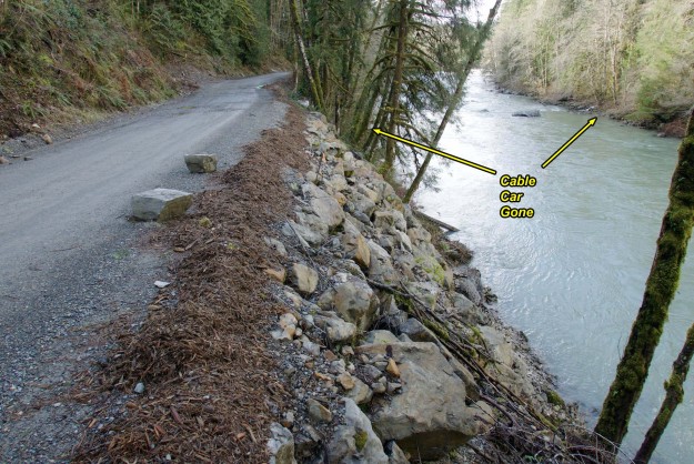
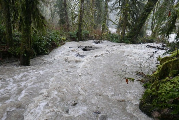
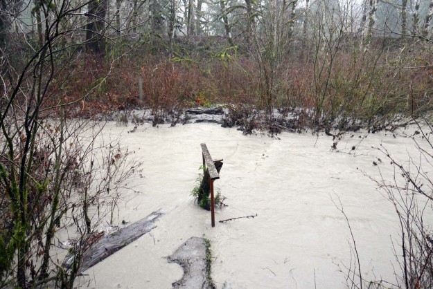
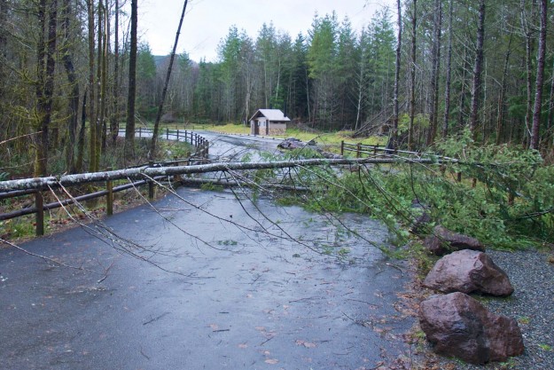
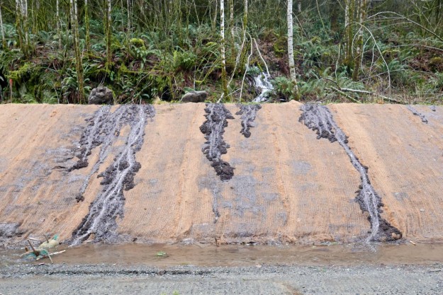
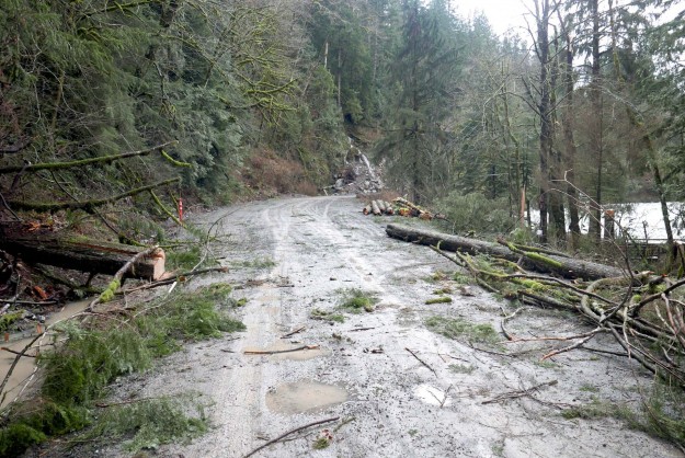
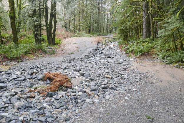
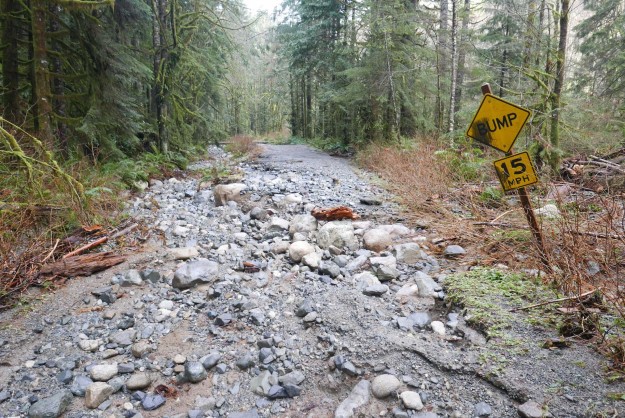
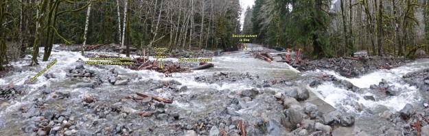
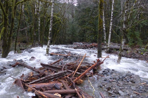
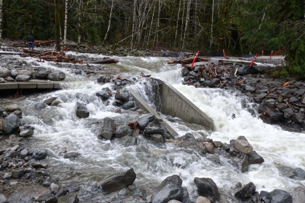
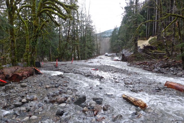
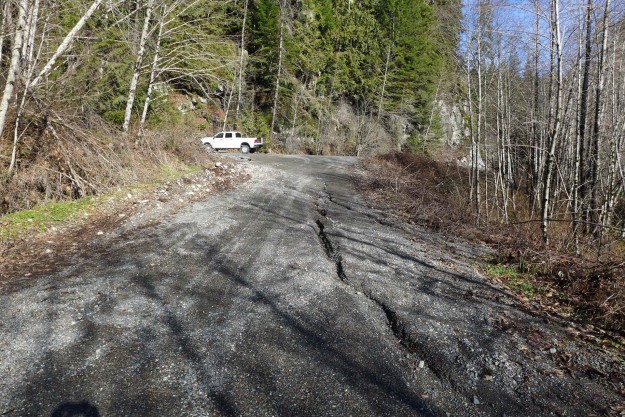
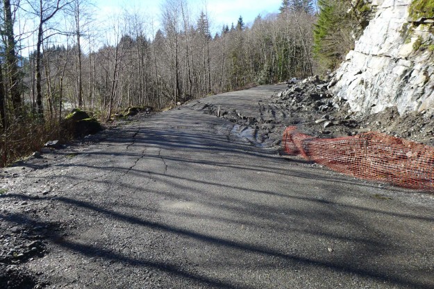
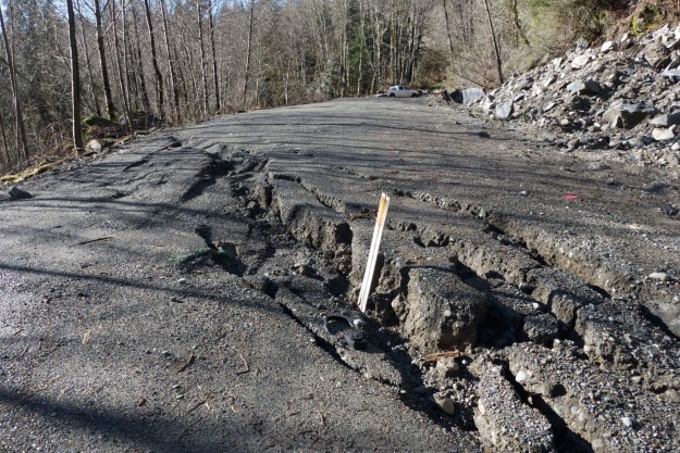
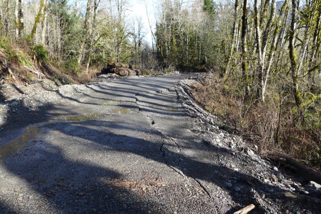
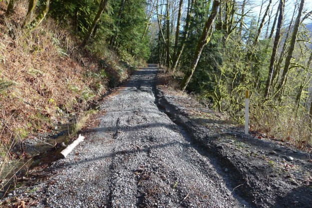
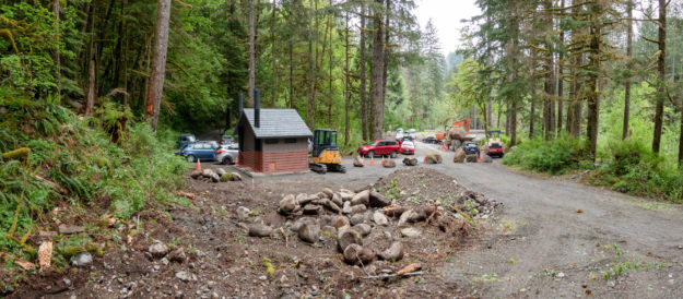
Five years after filing a plan to build a trailhead at the Dingford junction just past the Taylor River bridge the Forest Service began work on the new Garfield Ledges trailhead. It includes a two vault toilet, 4 parking pullouts, and eventually 14 picnic tables. This new trailhead also solves a problem that began in November 2015 when a series of floods washed out the 1/4 mile spur road to the Taylor trailhead leaving few parking spots for the popular hike to Lipsy Lake and Otter Falls. The washouts were too deep for most vehicles to drive through and eventually the road was blocked by barriers in November 2017 and continues to be. But at least there are plenty of parking spots now for all but the busiest weekends.

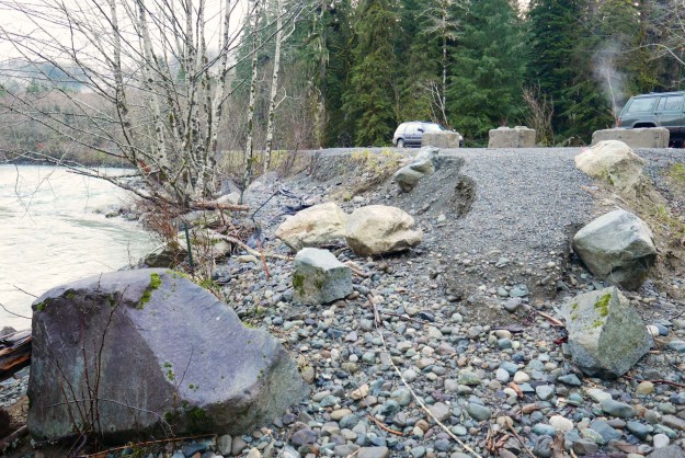
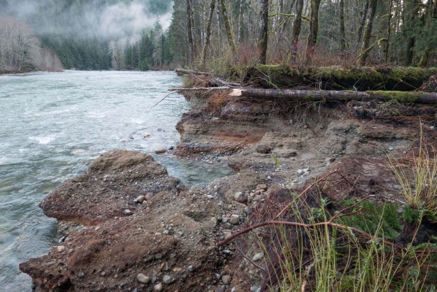
In the past this area just beyond the bridge was a very popular camping area with four dispersed camp sites along the Taylor river. Last summer a couple parties parked their RVs next to the sites and used them for at least the maximum 14 day stat. All of the sites have been converted to day use areas with picnic tables and it may come as a surprise when people drive up to use their traditional site and find out that camping is no longer allowed here.

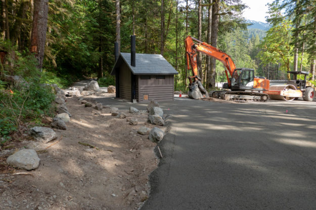
Simultaneously with the trailhead going in work resumed on the Garfield Ledges trail which starts to climb right behind the bathroom. Last year the last third of the trail was built by hand and now an excavator is being used to slowly carve out the trail beginning at the bottom.

20130930GarfieldLedgesTrailhead01

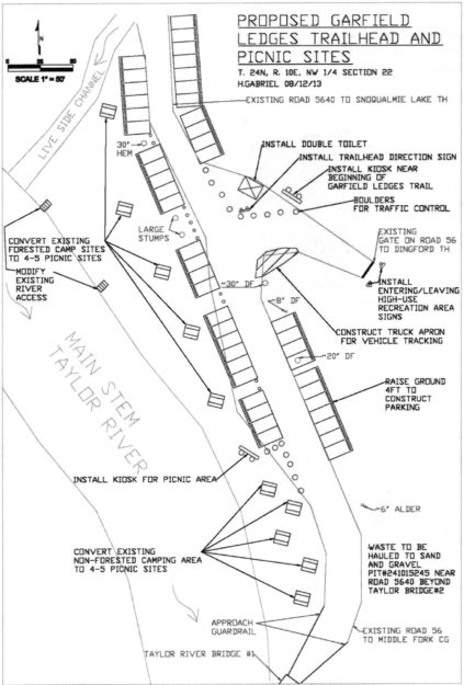
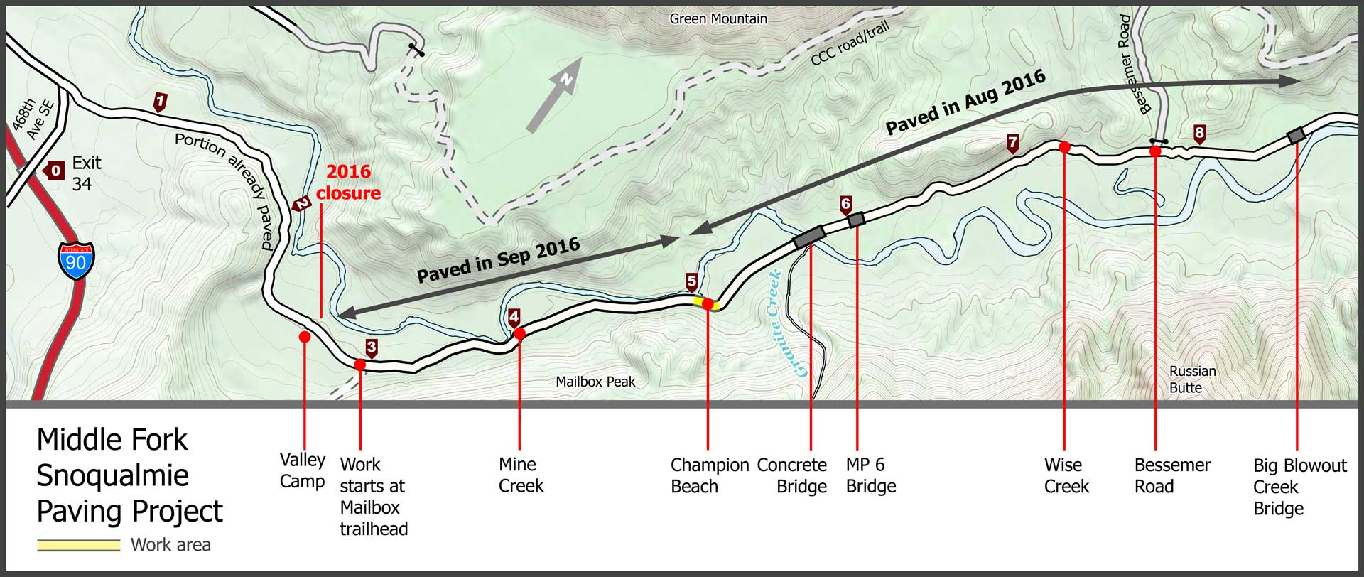
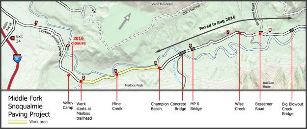
Early plans for the Garfield Ledges trailhead from the September 30, 2013 SOPA document for the Middle Fork Recreation Hub Project. It took 5 years for this to become a reality.


20171221GarfieldLedgesTrailhead02

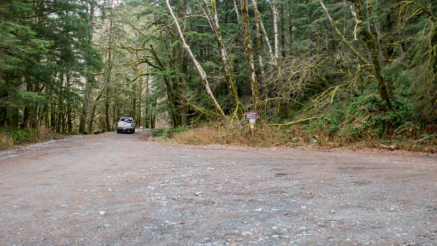
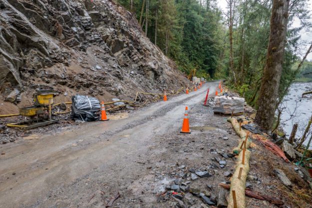
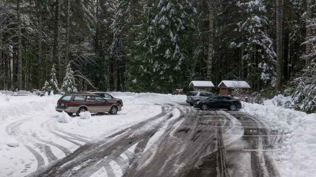
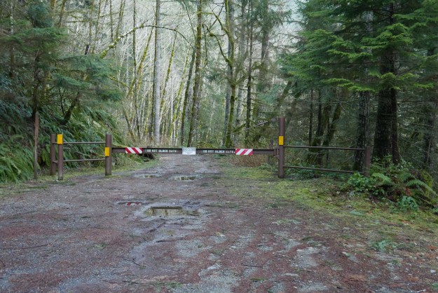
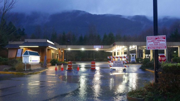
Dingford junction in December, 2017 before work began. The jersey barriers blocking the spur road to the Taylor River trailhead were installed in November, 2017.


20180514GarfieldLedgesTrailhead03

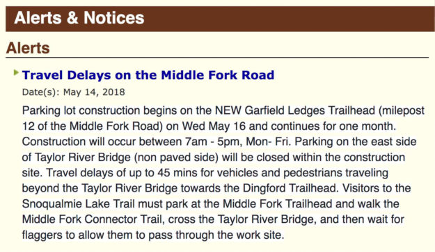
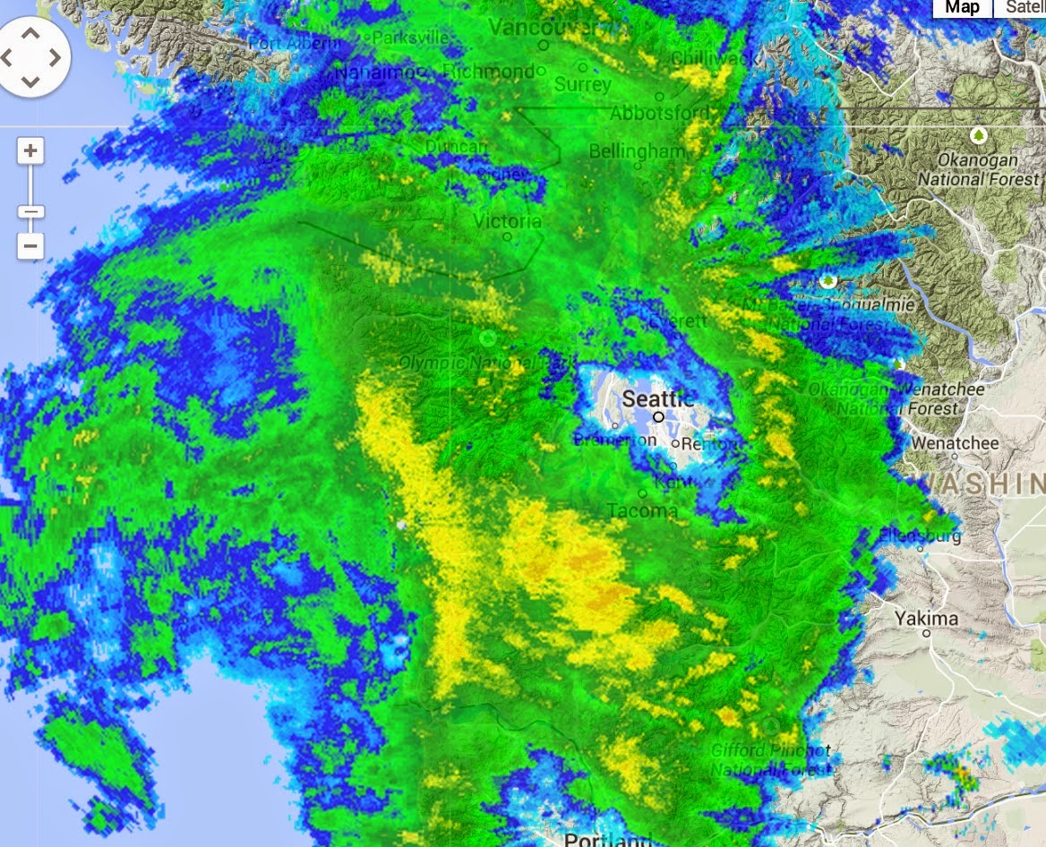
The USFS published an alert on their website about travel delays on May 14, 2018. Work began and May 16 and as promised was completed within about a month except for installation of the picnic tables.


20180520GarfieldLedgesTrailhead04

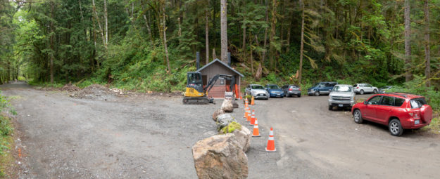
Work began in mid-May, 2018 with the first big change being the addition of a new two-stall bathroom.


20180520GarfieldLedgesTrailhead05

View of new bathroom looking down valley toward the Taylor River bridge


20180520GarfieldLedgesTrailhead06

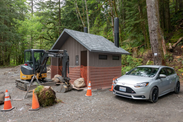
New bathroom with big rocks blocking doors to prevent early access!


20180520GarfieldLedgesTrailhead07

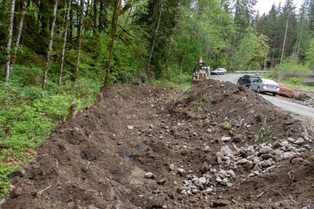
Creating a new parking pullout begins by digging a pit and filling it with gravel to ensure good drainage.


20180522GarfieldLedgesTrailhead08

New parking pullout with new gravel drainage base


20180522GarfieldLedgesTrailhead09

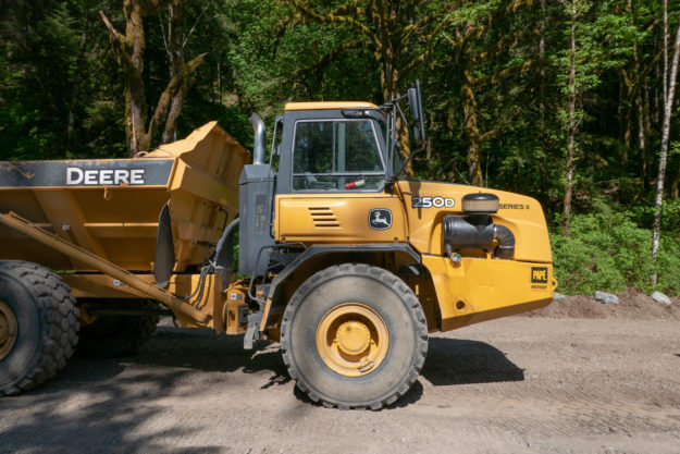
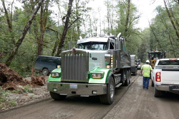
Big equipment used to haul gravel and debris up and down from the Hell Hill pit


20180522GarfieldLedgesTrailhead10

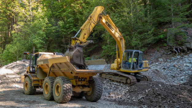
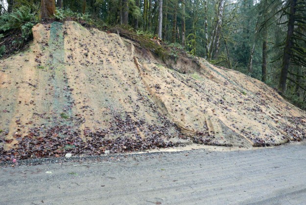
Most of the larger gravel used for fill came from the pit at the top of Hell Hill


20180615GarfieldLedgesTrailhead11

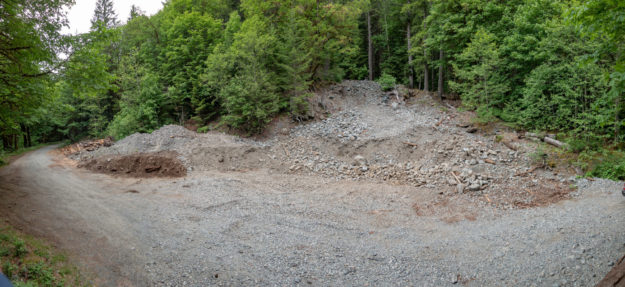
Hell Hill gravel pit usage is done for now and it was left somewhat cleaned up


20180529GarfieldLedgesTrailhead12

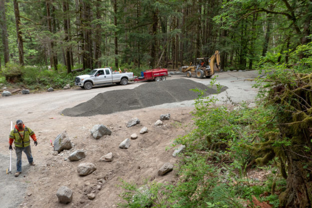
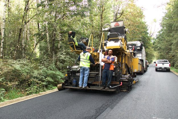
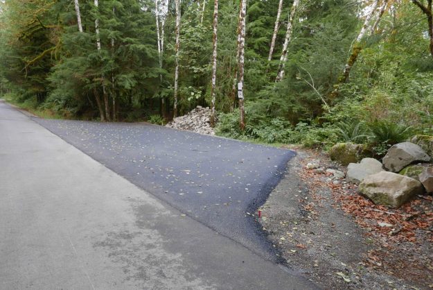
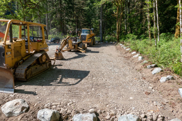
New surfacing gravel being trucked in for the top layer of the parking pullouts and picnic areas


20180529GarfieldLedgesTrailhead13

Lots of new gravel is spread around as the project progresses


20180529GarfieldLedgesTrailhead14

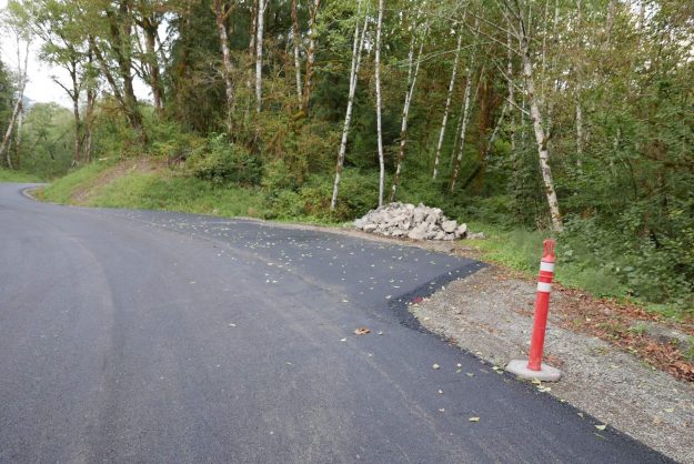
Picnic areas and parking pullouts get a top layer of gravel


20180529GarfieldLedgesTrailhead15

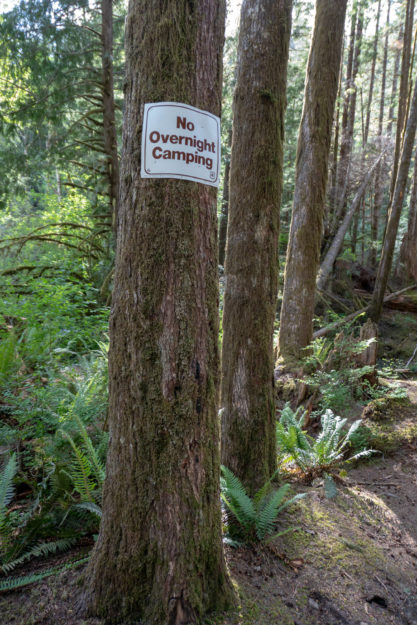
The Dingford junction area just beyond the Taylor River bridge has been a popular area for dispersed camping for many years. Camping is no longer allowed in this area.


20170617GarfieldLedgesTrailhead21

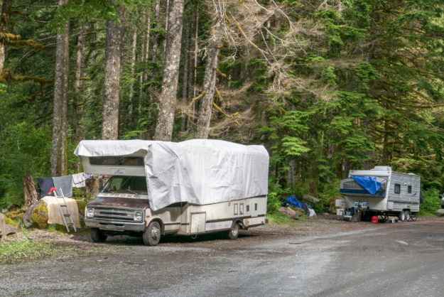
Two RVs set up for extended stays at the Dingford junction in June, 2017


20180605GarfieldLedgesTrailhead16

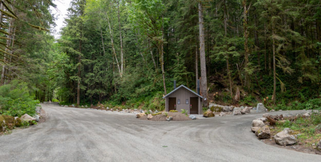
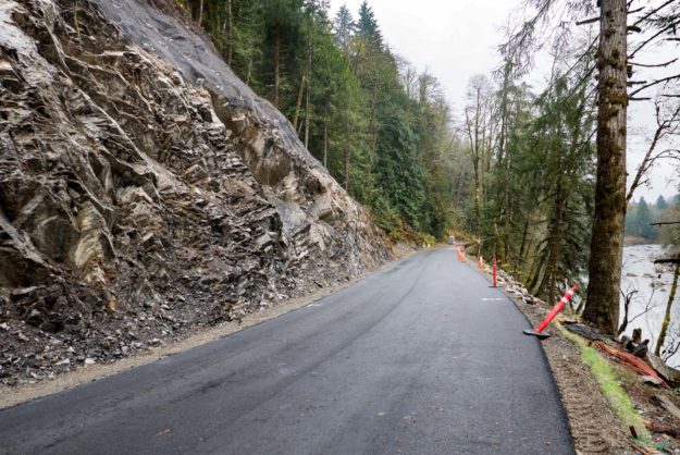
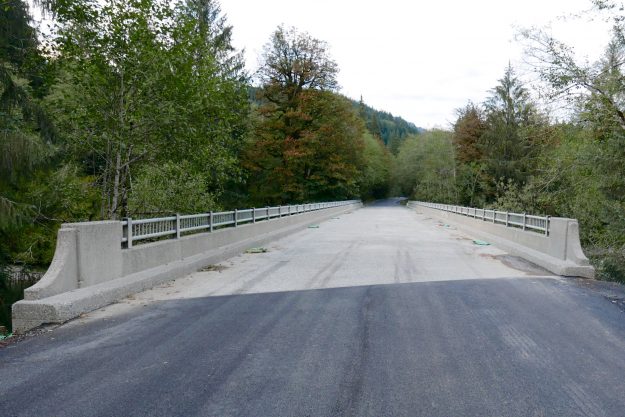
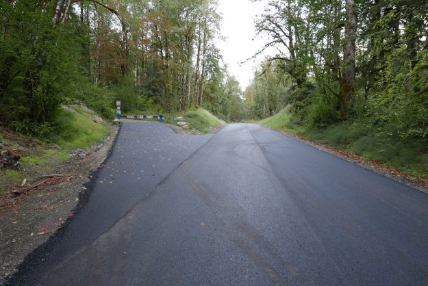
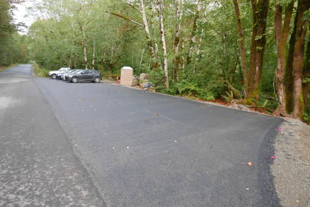
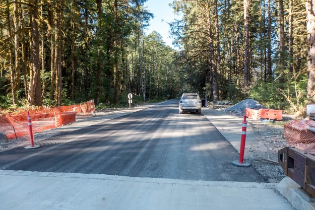
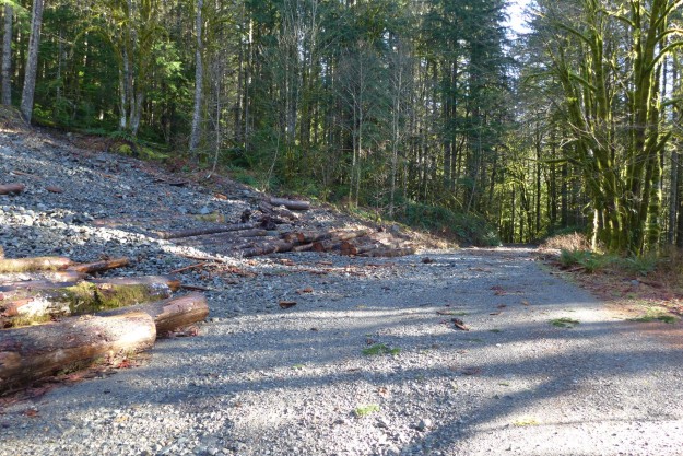
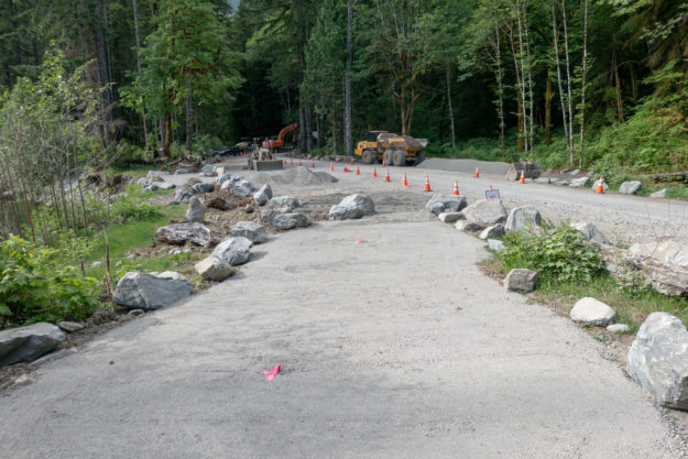
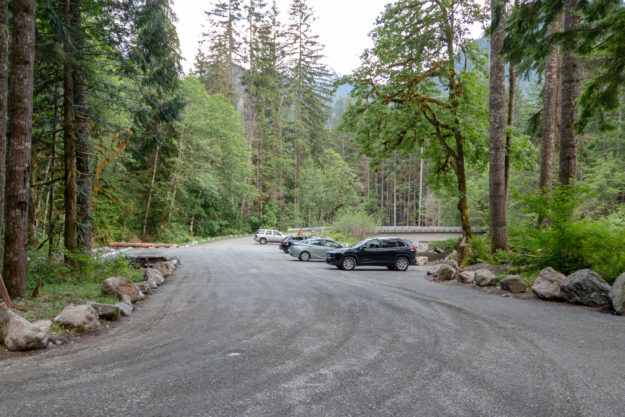
The completed project. The Taylor trailhead road to the left is still blocked. The road to the right climbs Hell Hill on the way to the Dingford trailhead.


20180605GarfieldLedgesTrailhead17

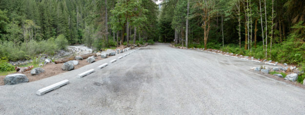
The completed project with many more parking spots than before


20180612GarfieldLedgesTrailhead18

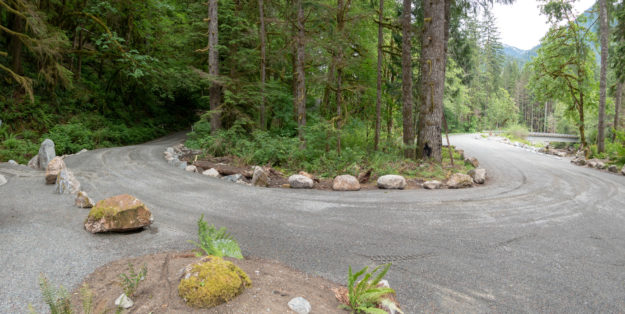
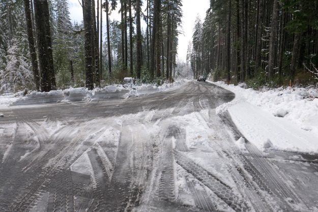
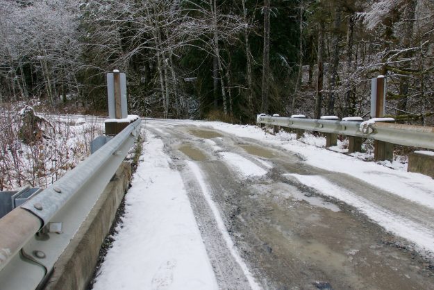
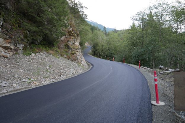
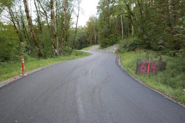
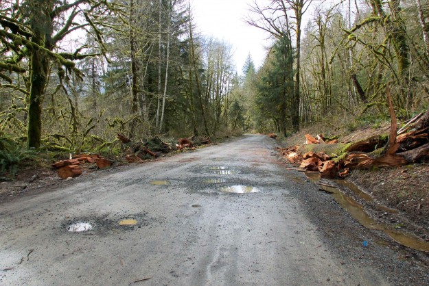
The turn in the road for climb up Hell Hill and after 6 miles of potholes, the Dingford trailhead. A new culvert was installed on the left to avoid persistent muddy ground in this area.


20180615GarfieldLedgesTrailhead19

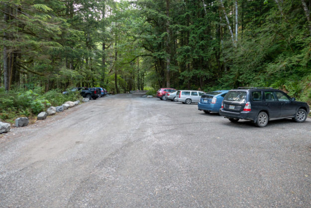
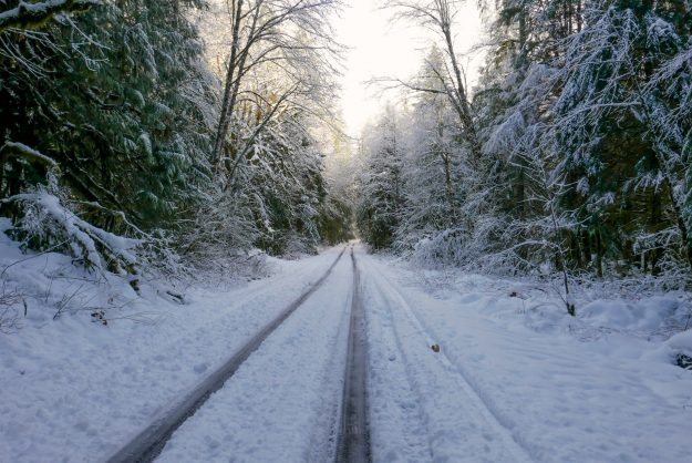
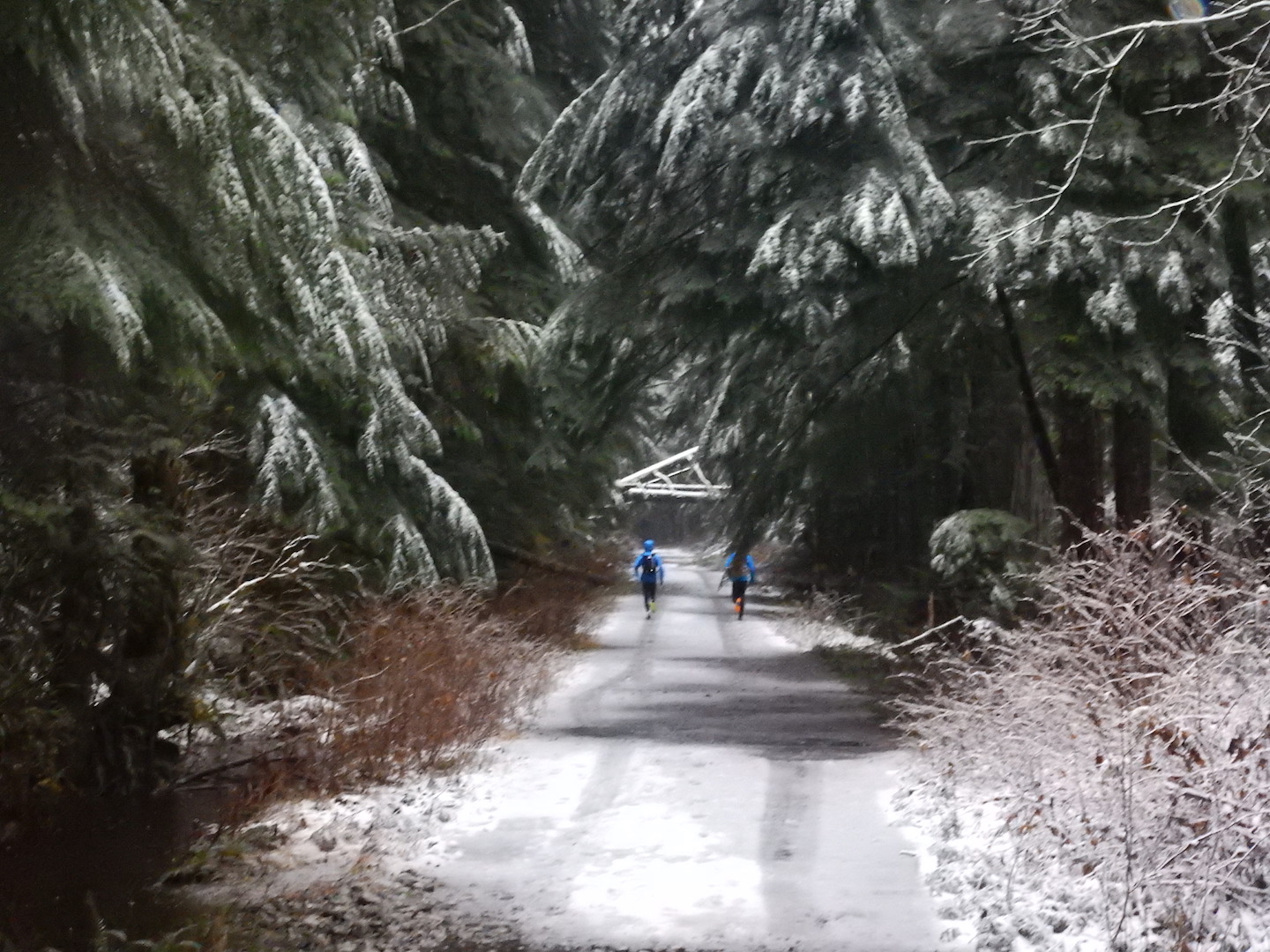
Hikers begin using the new trailhead for trips up the Taylor River trail


20180615GarfieldLedgesTrailhead20

Hikers using the new trailhead

Middle Fork Road Grand Opening

After many years of planning and four years of construction the grand opening of the newly paved Middle Fork road was celebrated on National Public Lands day, September 30, 2017. On the same day a ribbon cutting ceremony was also held for the recently completed Granite Creek trailhead and a reroute of a troublesome section of the Middle Fork trail. Multiple work parties were out this day as well, and everyone was invited to the Middle Fork campground for food and beverages to wrap up the festivities.

These videos include highlights of the comments from representatives of the many government and private agencies that contributed to these projects. The theme of the day was working together to realize the opportunities presented by the Middle Fork valley. For the sake of brevity, most of the recitals of thanks to various groups and individuals have been edited out, but a full transcription is available here.

The Mountain To Sound Greenway also has many excellent photos on Facebook taken by Ray Lapine.


It was convenient to have this celebration on National Public Lands Day, but there was still a short section of the road by the TANW1 river gauge that was not completed by this date. That would happen a couple months later when the final bit of pavement was laid down and the last guard rails installed in mid November, 2017.

20170930TANW1Unpaved

Unfinished section by TANW1 on the same day

20171104TANW1PavementCompleted

New pavement at TANW1 in early November

Related news coverage

09/29/2017 Living Snoqualmie: Grand opening celebration of new Middle Fork Road, multiple new trails happens this weekend

Middle Fork road gets plowed

An unexpected benefit of the paved road became apparent after two snow storms in early December left 6″ of snow on the Middle Fork road. Snow like this is not unusual, but typically doesn’t stick around on the valley floor very long and the road slowly becomes more accessible as trucks and other high clearance vehicles create ruts.

So it was surprising to many visitors that King County plowed the road on Monday, December 12 and then again in the morning on Tuesday. The plowing went as far as the Middle Fork trailhead, including the parking areas there and most of the parking pullouts along the road up to that point. Beyond the trailhead, driving was significantly more difficult because of deep ruts and the monster potholes that begin at the Taylor River bridge. Some vehicles were getting farther up the road, but not all (see photo below). With expected cold weather in mid December the slushy snow will turn to ice. Warmer weather is forecast before Christmas and the road will thaw out but continuing snow accumulation will continue to make it challenging to drive to the Dingford trailhead.

MiddleForkPlowing01

Plowing on both Monday and Tuesday made for an easy drive despite the heavy snow accumulation

MiddleForkPlowing02

The plowing extended all the way to the Middle Fork trailhead, including the various pullouts along the road

MiddleForkPlowing03

The Middle Fork trailhead would have been inaccessible without plowing. The bathroom is open but not serviced in the winter so bring your own TP.

MiddleForkPlowing04

Beyond the Middle Fork trailhead the road was not plowed and only passable to high clearance vehicles with good traction

MiddleForkPlowing07

Taylor River bridge potholes before the most recently snow storm. They can be slippery and difficult to drive through when traction is reduced by slush and deeper snow.

MiddleForkPlowing05

Whether walking or driving, winter in the Middle Fork can be beautiful. Here the sun shines through cold fog at the Taylor River bridge.

This Chevy Trailblazer tried to drive up Hell Hill and ended up stuck in a muddy ditch. Later his friends came in a pickup to pull the vehicle out.

Road paving nearly completed

In September, 2016 the remaining section of Middle Fork road was paved, from Valley Camp to Champion Beach. A short section at the problematic cliffs near Champion Beach will be finished in 2017 under a new contract. It’s not a smooth drive all the way to the Taylor River bridge.

Paving completed in 2016

Paving completed in 2016

More miles paved in August

In the last 2 weeks of August, 3.5 more miles of the Middle Fork road were paved, from Champion Beach to Big Blowout Creek. Weather permitting, project management expects to pave the rest of the road to Valley Camp before the end of construction for this year on October 31, 2016.

2016augpaving

3.5 miles paved in August, 2016


20160831NewPaving01

New pavement in progress with asphalt trucks coming out

20160831NewPaving02

Second layer of asphalt being applied

20160831NewPaving03

A worker cleans years of accumulated cruft from the concrete bridge rails

20160903NewPaving04

Cleaned concrete bridge

20160903NewPaving05

New pavement by rock outcrop before Wise Creek

20160903NewPaving06

Newly paved approach to Bessemer Gate

20160903NewPaving07

Paved wiggle in road just after the Bessemer Gate

20160903NewPaving08

Newly paved pullout at upper Oxbow Loop

20160903NewPaving09

Newly paved pullout at Russian Butte view

20160903NewPaving10

Newly paved pullout at Pratt River Bar

Gates and locks vandalized

During the last week three of the Middle Fork gates and/or locks were vandalized. The Bessemer Gate (DNR) was bent out of shape and hanging open until it was partially repaired and the lock replace.

20160220BessemerGateDamage

The Bessemer Gate is mostly back together but these bars were pulled away from the hinge post.

The left-side lock on the Taylor Campground gate was removed and was still missing as of February 21. It may have been cut off twice.
20160220TaylorCampgroundGate

The lock was cut off the left Taylor Campground gate and the signs were tagged. The graffiti was quickly removed by volunteers.

The lock was also cut off the Dingford gate — quite a trick as located in a hard to access spot inside a sturdy metal post. No damage to the Dingford gate itself was observed and the lock has been replaced.
20160220DingfordGate

The Dingford Gate lock was removed, but a replacement was in place quickly


In addition the cable car just downstream of the TANW1 river gage was removed by the USGS because nearly every time they came out the lock had been cut and the cable car was stranded in mid-span. This has been going on for several years and the USGS started locking the cable car in 2012. In the future the river gage engineers will us a remote controlled device to calibrate the gage by measuring water flow at various depths and locations across the river. This is what used to be done in a more manual process by lowering a flow meter from the cable car.
20160220TANW1CableCarGone

The TANW1 cable car has been removed

20130215TANW1Calibration

USGS engineer measuring river flow to calibrate the TANW1 gage

20131203StrandedCableCar

One of many times the TANW1 calibration cable car was stranded mid-span by vandals cutting the lock and setting it loose

Sitka spruce tree blocks road

A windstorm on the evening of January 28, 2016 was the final blow for a large rotting Sitka Spruce tree by the Bessemer Road gate, about 7 miles up the Middle Fork road. It fell across the road, completely blocking all access to the upper valley. Two early arrivals parked on the side of the road and did their planned bike ride or hike from there. But a couple heading for Goldmyer Hot Springs were determined to get through so drove back home to get a chain saw and try to get enough of the tree cut out to drive through. Soon after they started working other locals that often help with tree clearing showed up and steady progress was made clearing the 3-foot diameter tree. After about an hour a 2-person King County road crew arrived with bigger chainsaws and a truck with a winch. They were able to cut through a healthier part of the tree and drag a large section out of the way. Normally King County is not responsible for road clearing because the paving project is not done, but they came out because they were concerned that people farther up the valley might be stranded. A path was finally cleared by about 3 PM.

20160129SitkaSpruceDown01

Big Sitka Spruce blowdown by the Bessemer Road junction

20160129SitkaSpruceDown02

Vehicles headed up the valley are blocked

20160129SitkaSpruceDown03

Volunteers start cutting through the rotten and splintered lower section

20160129SitkaSpruceDown04

A King County crew showed up with bigger chainsaws and cleared a bigger and heavier section

20160129SitkaSpruceDown05

By 3 PM a path was cleared enough for vehicles to pass

On February 5 another King County crew equipped with a big excavator returned to the spot to complete the clearing.
20160220SitkaSpruceDown06

On February 5 the tree is completely cleared


December storm extends road closure

Just as the Middle Fork road was about to be opened for the winter season another major storm blew through resulting in yet another extension of the closure. Four inches of warm rain was recorded at Valley Camp for December 8 with an additional 1.22 inches the following day. The TANW1 gage showed a double peak, first at 25,000 cfs at 6pm on December 8 and 24,000 cfs at 5:15am on December 9.

After seeing the effects, the road closure was justified as wind gusts blew down numerous trees, mostly in the first two miles of the road above the Mailbox trailhead. About seven medium sized trees blocked the road to the Dingford trailhead and these were cleared by Friday. Reports continue to come in of blowdowns on trails, but the full impact of this series of severe winter storms may not be known until spring.

After the storm on Wednesday, December 9, a geotechnical engineer inspected the slope and Champion beach and approved opening the roadway through the slide area. There is barrier in place to catch any debris that may come down. ACI is clearing the downed trees through the project area and the road may be open to the public as early as Thurday, December 17.

Atmospheric River from Cliff Mass weather blog

Atmospheric River from Cliff Mass weather blog

TANW1 Discharge

Early forecasts for this storm predicted a very dangerous crest of up to 32,100 cfs. Fortunately that did not occur or else much more damage would have been done.

Early forecasts for this storm predicted a very high crest of up to 32,100 cfs. Fortunately that did not occur or else much more damage would have been done.

Comparison of the four major storms so far in 2015. The most recent storm didn't crest quite as high but lasted longer

Comparison of the four major storms so far in 2015. The most recent storm didn’t crest quite as high but lasted longer

20151209FloodedRoads

SW Mt Si Blvd was blocked off here and at Bendigo Blvd

20151208BrawlingCreek

Brawling Creek just above the Middle Fork river

20151208SitkaSpruceCreek

Sitka Spruce creek trail bridge was partially washed out and submerged under murky clay-filled water

20151209MailboxBlowdown

Trees down blocking the Mailbox trail parking lot

20151209MudFlowPattern

Small creek creates interesting mud flow patterns

20151209IslandDropBlowdown

Blowdown cleared by Island Drop

20151209MineCreekBridgeDamage

Mine Creek bridge damage

20151209MineCreekBlowdown

Blowdown by Mine Creek

20151209ChampionBeachRockButtress

Temporary rock buttress supporting Champion Beach road cut

20151209ChampionBeachOverview

Overview of area by Champion Beach that has been a concern for earth movements

20151209TopOfRockButtress

Area above temporary rock buttress that protects the road against minor mud and clay slumping

20151209RoadBlockedByTree

Big tree blocking road beyond Champion Beach

20151209SmallSlumpByRoad

Slumping road cut

20151216MiddleViewPulloutErosion

Partial washout of a dispersed camping site pullout. This pullout was built in 2014 as part of the paving project.

20151216SevereBankErosion

Severe bank erosion by a dispersed campsite downstream of Camp Brown. The river is aggressively migrating toward the road here with each major storm.

20151216TaylorSpurErosion1

Further erosion of the Taylor River spur road. The river will likely flow here often now so it’s unlikely this will be repaired to a level suitable for motorized access.

20151216TaylorSpurErosion1

Further erosion of the Taylor River spur road. The washout is deeper than it appears in this photo.

20151211NewBlowdownOnDingordRoad

Fresh blowdown on the road to Dingford Creek from this storm. This was the major impact between the turnoff at the Taylor River and the Dingford Creek trailhead. Photo by Charles Lingel.

Before and after clearing debris from the road

Not all trees fall during the storm. The high water undercut the bank and the next big snow fall brought the tree down.

Not all trees fall during the storm. The high water undercut the bank and the next big snow fall brought the tree down.

Related News

Two More Miles Paved

2 more miles of the Middle Fork road were paved in early August, 2015 between the Big Blowout Creek and MP 10.6 bridges. This video was taken the first weekend after the paving was completed.

20150731StartOfNewPavement

Big Blowout Creek crossing with new pavement starting from the far end of the bridge

Severe rain storm closes Middle Fork road

In early January the northwest was the recipient of another atmospheric river delivering moisture from the central Pacific. Cliff mass wrote “As much as 13 inches on the coast, with many locations getting 5-8 inches. But less than a quarter of an inch in the rain shadow over parts of Puget Sound and NW Washington. Big totals (4-6 inches) along the western slopes of the Cascades.” Rain gages in the North Bend area recorded over 4 1/2 inches of rain within a 24 hour period and the Middle Fork river responded with the 8th highest recorded flow to-date. Unfortunately the TANW1 gage, which is the only one that measures the Middle Fork in isolation failed midway through the event, but the last measured discharge* was 27,300 cfs at 11:15am, a couple hours after the rain had let up so the actual peak was likely close this value.

20150105RiverAccessUnderWater

Flooded river access by Concrete Bridge

20140105RainMeasurements

Precipitation map for Middle Fork area. The North Bend stations would eventually record 4 1/2 inches of rain on the morning of January 5.

20150105TANW1Gage

Discharge as measured by the TANW1 river gage. Unfortunately the gage failed midway through the storm so the rest of this graph was inferred as a proportionate estimate from downstream gages measuring the combined flow of all three forks.


An event with such high flows would normally have serious consequences for the Middle Fork road. This time was unique in that the Middle Fork paving project had completed the first of three years of work with the last two miles of pavement completed including many new culverts for improved drainage. Most of the new work held up well to the extraordinary water flow levels but a few exceptions resulted in the road subsequently being closed until Memorial Day.

  • The biggest problem was at the newly constructed box culverts at the stream crossings just beyond the CCC trail, otherwise known as Bessequartz Creek. The problems with this creek date back to a landslide on the southeast ridge of Bessemer in the 1998-2003 period that deposited a load of rocks into the drainage. With each major rain event the rocks were moved further downstream, first inundating the road during the massive 2009 flood. This current flood brought down enough rocks and logs to completely block one of the box culverts. The stream then overflowed the road, covering it with small boulders and forming new drainage channels across the recently reconfigured road bed.
    20130601BessemerRidgeLandSlide

    Old landslide scar visible on Bessemer’s southeast ridge

    20150105BessequartzWashout1

    Bessequartz Creek washout

    20150105BessequartzWashout2

    View up Bessequartz Creek showing the rocks and logs that have filled up the previous stream channel and blocked the box culvert. The stream should be draining directly under my feet.

    20150105BessequartzWashout3

    Almost no water is coming through the culvert because it’s blocked on the upstream end. The water has undercut the concrete slats.

    20150105BessequartzWashout4

    View of the Bessequartz Creek washout from the upstream side

  • A second major problem occurred just before the Bessequartz Creek crossing by the CCC trail junction where the road slumped because of a soft and unstable lens of clay under the road bed. The same area has been a problem in previous years as well. The paving plans call for a “deep patch” in this area which will reinforce the upper few feet but will not help with the underlying problem.
    20150125MiddleForkSlump1

    Small road slump and erosion approaching the CCC trail junction

    20150125MiddleForkSlump2

    Road slump by CCC trail junction

    20150125MiddleForkSlump3

    Road slump by CCC trail junction

  • A third issue was a minor road slump just beyond the Bessemer road. This would later be addressed with another “deep patch” of the road bed.
    20150125BessemerGateSlump

    Road slump just past the Bessemer road

  • The road just past the Dingford turnoff up Hell Hill is frequently subjected to runoff and this was no exception.
    20150125HellHillErosion

    Newly eroded gully on the road up Hell Hill

  • The wash at the top of Hell Hill is used by the Forest Service as a source of gravel fill and they got a fresh supply delivered by Garfield Mountain. This time it partially covered logs stored there that were cleared from the right of way as part of the paving project.
    20150125HellHillGravelPit

    Garfield Mountain delivered a fresh round of gravel to the wash at the top of Hell Hill, covering the logs placed there from paving project clearing of the Middle Fork road.

These issues resulted in the closure of the road, ultimately until Memorial Day. The Forest Service’s Facebook announcement stated “The Mt. Baker-Snoqualmie National Forest is closing the Middle Fork Snoqualmie River Road (Forest Service road 56) for public safety until further notice. The road has recently experienced major storm damage making the road impassable. The Middle Fork Snoqualmie River Road will be closed at mile 2.2, near Valley Camp and Mailbox Peak Trailhead. At this time, Federal Highways Administration officials are determining how best to repair the road.”

Related News

* Some time after the event, the USGS retroactively removed TANW1 raw data from the record back to midnight on January 5 because it could not be calibrated. Fortunately, we were able to capture that last morning of measurements and based on experience of observing other high water events it was close to reality even if not up to USGS standards.