Category Archives: Mailbox

Mailbox summit trail spares trees

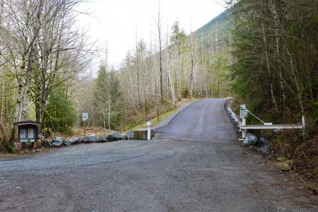
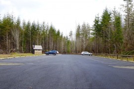
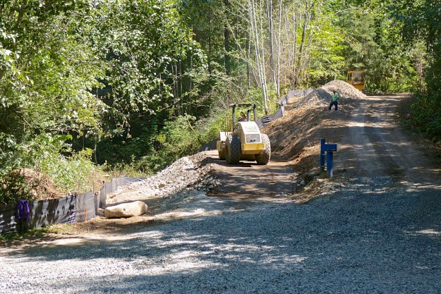
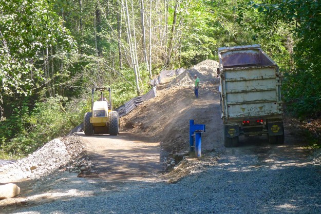
The DNR has been building the new Mailbox Peak trail for several years and it’s nearly complete. Work on the lower switchbacks began in 2012 using a small excavator while another crew worked by hand down from the top. A new parking lot was built in 2013 and by the end of that year the new trail connected with the old trail at 3900′, just below the big talus field. Work continued in succeeding seasons to add bridges, improve drainage at smaller creek crossings, and improve the tread.

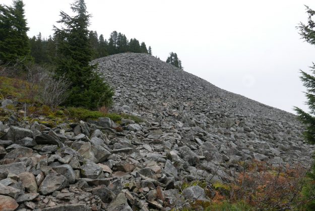
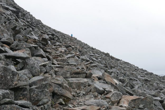
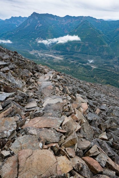
In 2016 most of the work was focused on the section of trail through the talus field and continuing on an open ridge to the summit. The old trail alignment veered to the north side of the ridge line and passed through a grove of old growth hemlock trees. They were beautiful and stately, but the impact of thousands of boots stepping on the trail that was in large part roots of these trees threatened their health. Heavy duty rock work was required to construct trail switchbacks through the talus, but this trail will melt out sooner in the spring and is indestructible. Above the talus the tread is now restricted to a single path instead of multiple braids, and much of it has been improved with sturdy rock steps. Previously this was an erosion-prone dirty gully with rocks continually working loose from boot traffic.

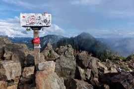
Only a short section remains before the new Mailbox trail is completed, and we can expect that to occur in 2017.

20161025NewMailboxTrailThroughTalus

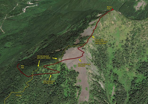
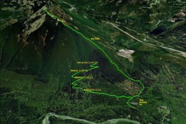
Illustration of work done on this year on the upper section of the new Mailbox trail. The work on the final section to the summit is not complete yet.

20161025Mailbox01

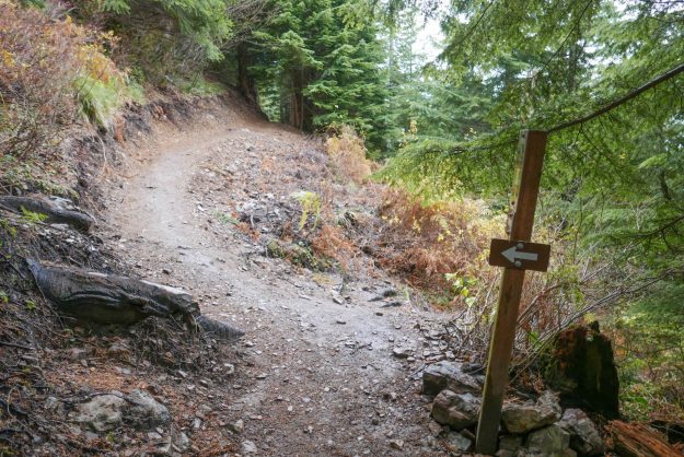
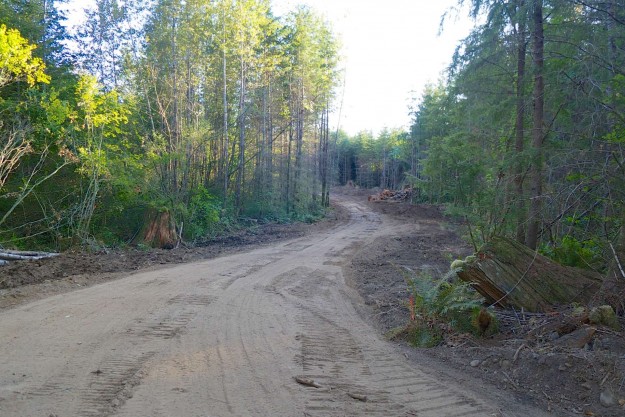
Junction of the new and old trails. The new trail now goes straight ahead instead of steeply up to the left.

20161025Mailbox02

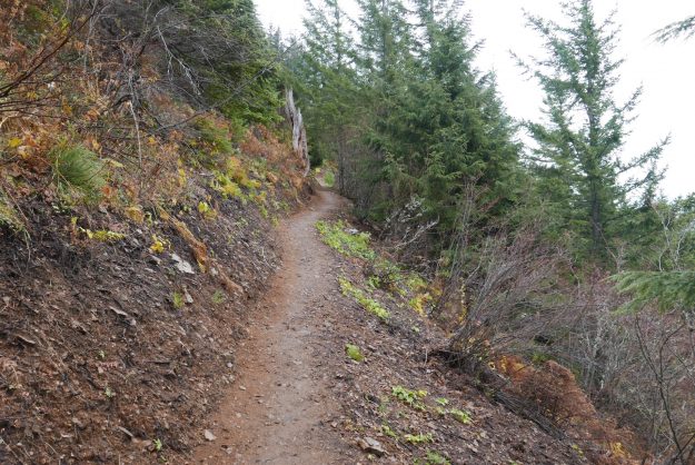
Easy section just past the new/old trail junction

20161025Mailbox03

New switchback on the south side below the talus field

20161025Mailbox04

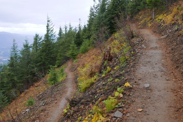
The new trail enters the talus field on the south side of the ridge. This avoids the rooty trail through the old growth hemlocks which would have harmed them over time.

20161025Mailbox05

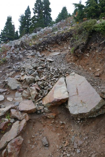
New trail through talus

20161025Mailbox11

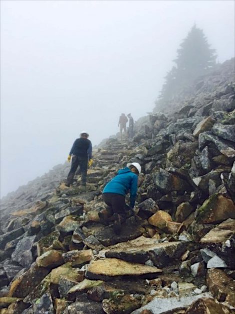
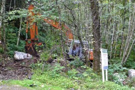
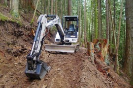
Building a trail through the talus field. Photo courtesy of DNR.

20161025Mailbox06

The crew did a great job laying flat stepping stones here

20161025Mailbox07

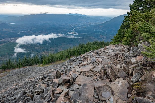
This is the top of talus trail section where the trail leaves the talus field

20161025Mailbox08

The blocked old trail from the other side of the blockage. There’s no reason for anyone to go this way now — the talus field has big views and secure footing.

20161025Mailbox09

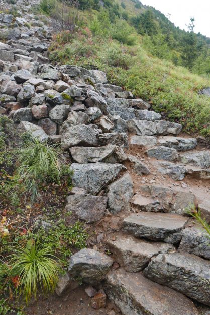
Well done rock step work where it used to be semi-loose rocks in a dirty gully

20161025Mailbox10

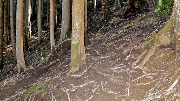
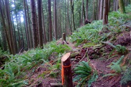
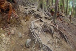
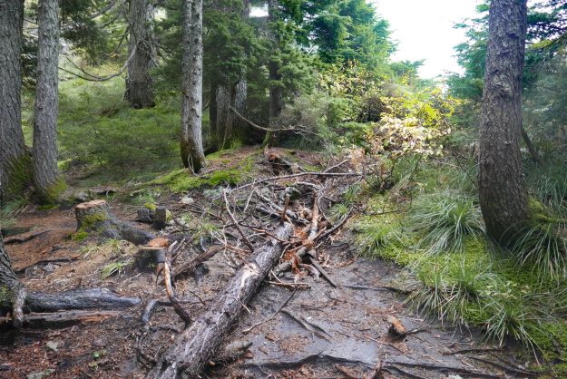
Obviously this is beyond the point that the trail crew got to. This is what much of the ridge trail used to look like.

Mailbox parking lot open weekends

As of Friday, March 7, 2014 the Mailbox peak parking lot will be open each Friday, Saturday and Sunday. At the same time the concrete gabions with a “No Parking” message in the pullout north of the road were turned around. Is it ok to park here now? Probably not — no agreement has been reached between the DNR and the property owner so if the gate is closed or the parking lot is full you are better off parking on the south (gate) side of the road if there’s room, or along the road.

20140307MailboxParkingLotOpenWeekends01

A welcome open gate

20140307MailboxParkingLotOpenWeekends02

Still lots of room today

20140307MailboxParkingLotOpenWeekends03

Concrete gabions temporarily turned around

Mailbox Switch

The 11th transition of the mailbox on Mailbox occurred between Christmas 2013 and New Years 2014. This has become a regular back and forth contest between the majority of people that think the mailbox-on-Mailbox is fun and a few that think it somehow diminishes the summit. If you are in the latter camp, be aware that when the mailbox was removed, there were three parties on the trail to replace it on December 29. The first one up placed theirs, then on the way down alerted the others that the mailbox had already been restored and they could lighten their load and enjoy the hike without hauling a new mailbox to the summit. That means the peak was mailbox-less for less than 4 full days.

20131229MailboxSwitch01

Missing mailbox on Christmas afternoon, photo by Russ Kula

20131229MailboxSwitch02

5 days later … new year, new mailbox


The new mailbox was placed in pristine condition, but within a day the cryptic epigram “DBT 4962” was applied to the door. If you know what that means, email me!

Busy rescue year on Mailbox Peak

20130630BusyMailbox01

Summit register page

DayHikingSnoqualmieRegionDespite a steep indistinct trail and 4000 feet of gain, Mailbox Peak has become one of the most popular day hikes in the central Cascades. On Sunday, June 30, 2013 over 100 hikers signed the summit register and many who hike the peak regularly don’t bother with that formality. The Day Hiking Snoqualmie Region guide book leads with “Wimpy hikers, turn the page. This trail offers nothing for you but pain and heartbreak”, and yet thousands each year test themselves.

20130202BusyMailbox02

Mailbox, February 2013

20130630BusyMailbox03

Mailbox, June 2013 by masterqhuy

20131116BusyMailbox05

Mailbox, November 2013

20130903BusyMailbox04

Mailbox, September 2013


Unfortunately some come unprepared, get lost, start too late, or suffer an unfortunate slip and can’t get down before dark or on their own power and that happened a lot in 2013. Stranded hikers enjoy good cell phone coverage on this trail so they generally call 911 and get routed to the King County sheriff’s office who coordinates with Seattle Mountain Rescue to respond. Even if the hikers don’t know exactly where they are, SMR is able to triangulate an approximate location based on cell tower timings. Their records list these missions, and you can bet that lots of others didn’t call them and limped down on their own. Reading these can be useful to help other parties plan better, use caution, and come prepared for a significant effort on a hard trail.

  • April 15, 2013 – At 5:30 pm a hiker injured herself 1 1/2 miles up the trail and was carried down in a litter, reaching the trailhead at 11:30 pm. There was a mix of snow ice and slush on the trail which contributed to the injury and also made it difficult for the rescue team.
     
  • May 3, 2013 – A women injured her ankle while descending and called for help at 5 pm from a spot 2 miles up the trail, then continued walking slowly down. She did not need to be carried and SMR members assisted her down the trail, arriving at 8:30 pm.
     
  • June 30, 2013 – On a hot day an experienced hiker on a training hike was running down the trail following the white diamond trail markers. Then there were no diamonds. He continued down hoping to intersect the trail lower on the mountain, but he was on the south side heading for the Fire Training Center. There are some old trails on that side but they are faint and one could cross them without even noticing. He called for help at 6 pm and the SMR team was able to find him with the help of a GPS signal from his phone. Ironically, heading in the right direction they were able to make it down to the cars in only 11 minutes.
     
  • 20110501BusyMailbox08

    Where’s the trail?

  • October 5, 2013 – Near dusk, a hiker lost the trail called for help at 7:38 pm. Triangulation placed him just below timberline and south of the trail. This is the hardest area to follow the “trail” because it splits into a myriad of paths down a wide area covered in ruts and roots. There are white diamonds but not that close together and it takes some effort to follow them. The hiker was instructed to respond when he heard the searcher’s voices or saw light. They reached him at 10:40 pm and got down just before midnight.
     
  • October 6, 2013 – One day later a similar incident occurred. A lost hiker called near dusk at 7:39 pm and was reached by the rescue team at 9:07 pm. The location isn’t specified, but based on the time to descend it was likely near the same confusing spot as the day before. They were down to the parking at at 11:05 pm.
     
  • October 26, 2013 – Two lost hikers called for help at 8:08 pm, probably after dark. Sadly, they were told by friends to hike Mailbox because it was an “easy beginner’s hike” and that made them think it was ok to start at 1:30 pm. Having lost the trail they ended up making a signal fire at about 1600′, which helped keep them warm and in good spirits. They were reached at 10:30 and got down an hour later.
     
  • November 24, 2013 – A young couple Googled “Mailbox Washington” for their beta, but found it “was harder than it said!”. That’s a stretch because none of the first few results mince words about how difficult this trail is. They had no flashlights, lost the white diamonds, and ten minutes later called for help at 5:30 pm. Via multiple phone calls they were found at 7:13 and down in only 20 minutes. They didn’t realize the white diamonds are only present on the upper parts of the trail, and without a flashlight couldn’t easily follow the trail down.
     

It’s pretty obvious why the DNR, the Sheriff and SMR put up the warning sign at the trailhead, installed the white diamonds, and put in railings at critical points along the trail to keep people on track. Even better will be the new trail currently being constructed by the DNR — look for that to be ready in the fall of 2014.

20120926BusyMailbox07

White diamond

20130903BusyMailbox06

Trailhead warning

Mailbox parking problems

20131105ParkingProblems1

20110415ParkingProblems2

Signboard appears offering land for sale in April, 2011
  

Trailhead parking for Mailbox Peak has been a problem ever since the hike started appearing in guidebooks in ~2007 and it’s popularity started rising. The DNR built a new parking lot off the road in 2013, but it’s not scheduled to open regularly until the new Mailbox Peak trail is completed in 2014. For many years hikers parked in the pullout on the north side of the road, and in the small loop in front of the gate leading to the trail itself. But some trouble started in 2011 when for sale signs appeared for property on either side of the road.
20110501ParkingProblems5

Typical busy day at Mailbox with the north pullout full and overflow parking along the road


20110415ParkingProblems3

Location of parcels

20121102ParkingProblems4

“Sale Pending” in 2012

Nothing changed for a year and a half until the property was nearly sold and “Sale Pending” placards appeared. But something clearly went south because the property was not sold and a year later four large concrete blocks were placed in the pullout parking area with messages making it very clear that parking was forbidden. In the next couple weeks an access road to the parcels on the south side was cleared and more concrete blocks showed up.
20130903ParkingProblems6

Excavator opening access to property

20130903ParkingProblems7

Cleared road provides access to property for sale


This site does not cover private property issues other than transfers to public status, so no attempt will be made to explain this sequence of events. However, as of February, 2014 the DNR seems to be negotiating to purchase these properties to prevent development from creeping farther up the valley.

Mailbox parking lot opens

As of July 1, 2013 Mailbox Peak hikers can start using the new parking lot on weekends and holidays from 7am to dusk. Don’t know when dusk is? It will be posted on the gate so you will know ahead of time what time to be back to your car. The hours are limited to prevent late-night partying — city (North Bend), county (King) and state (DNR) budget crunches prevent frequent patrols of the parking lot.

As at many easily accessible trailheads, vandalism continues to be a problem. Cars parked along the road experience regular breakins, most often the less busy days (Monday through Thursday) when the perpetrators are likely to be alone long enough to avoid detection. Never leave valuables in the car while hiking.

This gallery captures a series of steps in the construction of the new parking lot. Enjoy the restrooms!

More construction photos in this August 2012 post.

National Trails Day on Mailbox Peak

20120601NationalTrailsDay

A MTSG group gathers for work on the new Mailbox trail

This year National Trails Day, June 1, 2013, fell on a beautiful sunny Saturday. Volunteers gathered at many sites to contribute time to celebrate the day, but here we’d like to thank the group that gathered to continue work on the new Mailbox trail.

Mailbox parking lot

DNR begins construction of the new Mailbox Peak parking lot.

20120814MailboxParkingLot01

Building a solid shoulder for 2 lane access to the parking lot


20120814MailboxParkingLot02

Many trucks coming and going


20120814MailboxParkingLot03

Later the same day the shoulder has been built up to the level of the former single-lane road


20120814MailboxParkingLot04

View toward the new Mailbox parking area

New Mailbox trail

Work on the trail is progressing steadily. As of July 19, 2012 the Bobcat was up to ~2000′ with the cutters about 1/4 mile ahead of that.

20120719NewMailboxTrailMap

Map of Mailbox Peak progress

20120719NewMailboxTrail03

New Mailbox trail


20120719NewMailboxTrail02

New Mailbox trail, beyond the Bobcat, just cutters

20120719NewMailboxTrail01

Old Mailbox trail